Sfikiá geodata
Sfikiá (Central Macedonia) is a populated place; located in Greece in Europe/Athens (GMT+3) time zone. With population of 565 people, there are 1662 cities with bigger population in this country. Compared to other cities in Greece, 71.8% of cities are located further ↓South; 67.3% of cities are located further →East and 93.5% of cities have lower elevation than Sfikiá. Note1
Administrative division(s):
- Level 1: Central Macedonia
- Level 2: Nomós Imathías
- Level 3: Dimos Veroia


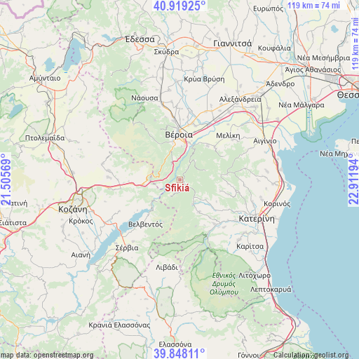
Sfikiá GPS coordinates[2]
40° 23' 8.916" North, 22° 12' 31.716" East
| Map corner | latitude | longitude |
|---|---|---|
| Upper-left | 40.91925°, | 21.50569° |
| Center: | 40.38581°, | 22.20881° |
| Lower-right: | 39.84811°, | 22.91194° |
| Map W x H: | 119.1×119.1 km | = 74×74mi |
| max Lat: | 41.72048° ⇑28.2% North |
| Sfikiá: | 40.38581° |
| min Lat: | ⇓71.8% South 34.8346° |
| min Long | Sfikiá | max Long |
| 19.40494° | 22.20881° | 29.59361° |
| W 32.7%⇐ | ⇒67.3% E |
Elevation
Elevation of Sfikiá is 614 m = 2014 ft, and this is 445.1 m = 1460 ft above average elevation for this country.
| Max E: |
1439 m = 4721 ft | 6.5% |
| Sfikiá | 614 m 2014 ft | |
| Avg. | 168.9 m = 554 ft | |
Min E: |
0 m = 0 ft | 93.5% |
See also: Greece elevation on elevation.city.
Geographical zone
Sfikiá is located in North temperate zone (between Tropic of Cancer and the Arctic Circle). Distance of this Northern Tropic circle is 1884.6 km =1171 mi to South.| Distance of | km | miles | from Sfikiá |
|---|---|---|---|
| North Pole | 5516.6 | 3427.9 | to North |
| Arctic Circle | 2910.7 | 1808.6 | to North |
| Tropic Cancer | 1884.6 | 1171 | to South |
| Equator | 4490.5 | 2790.3 | to South |


Nearby cities:
15 places around Sfikiá: (largest is in red/bold)
• Agía Varvára
12.6 km =7.8 mi,  13°
13°
• Diavatós
18.5 km =11.5 mi,  15°
15°
• Elatochori
8.5 km =5.3 mi,  150°
150°
• Káto Miliá
18.6 km =11.6 mi,  142°
142°
• Moschopótamos
10.8 km =6.7 mi,  128°
128°
• Palatítsia
15.8 km =9.8 mi,  46°
46°
• Polýmylos
12.1 km =7.5 mi,  262°
262°
• Ritíni
12.6 km =7.8 mi, 149°
• Rizómata
3.9 km =2.4 mi,  177°
177°
• Ryákia
15.7 km =9.8 mi,  83°
83°
• Ráchi
11 km =6.8 mi,  2°
2°
• Velventós
18.4 km =11.4 mi,  217°
217°
• Vergína
14.5 km =9 mi,  39°
39°
• Véroia
15.4 km =9.6 mi,  357°
357°
• Élafos
16 km =9.9 mi,  94°
94°
Sources, notices
• [Note1] Compared only with cities in Greece existing in our database
• [Src1] Map data: © OpenStreetMap contributors (CC-BY-SA)
• [Src2] Other city data from geonames.org with taken over terms of usage.
• [Src3] Geographical zone / Annual Mean Temperature by Robert A. Rohde @ Wikipedia
