Velventós geodata
Velventós (West Macedonia) is a populated place; located in Greece in Europe/Athens (GMT+3) time zone. With population of 3,378 people, there are 317 cities with bigger population in this country. Compared to other cities in Greece, 69.1% of cities are located further ↓South; 70.3% of cities are located further →East and 87.8% of cities have lower elevation than Velventós. Note1
Administrative division(s):
- Level 1: West Macedonia
- Level 2: Nomós Kozánis
- Level 3: Dimos Servia-Velventos


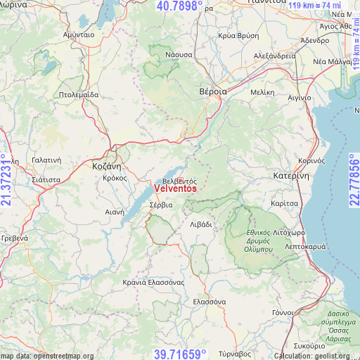
Velventós GPS coordinates[2]
40° 15' 19.152" North, 22° 4' 31.548" East
| Map corner | latitude | longitude |
|---|---|---|
| Upper-left | 40.7898°, | 21.37231° |
| Center: | 40.25532°, | 22.07543° |
| Lower-right: | 39.71659°, | 22.77856° |
| Map W x H: | 119.3×119.3 km | = 74.1×74.1mi |
| max Lat: | 41.72048° ⇑30.9% North |
| Velventós: | 40.25532° |
| min Lat: | ⇓69.1% South 34.8346° |
| min Long | Velventós | max Long |
| 19.40494° | 22.07543° | 29.59361° |
| W 29.7%⇐ | ⇒70.3% E |
Elevation
Elevation of Velventós is 452 m = 1483 ft, and this is 283.1 m = 929 ft above average elevation for this country.
| Max E: |
1439 m = 4721 ft | 12.2% |
| Velventós | 452 m 1483 ft | |
| Avg. | 168.9 m = 554 ft | |
Min E: |
0 m = 0 ft | 87.8% |
See also: Greece elevation on elevation.city.
Geographical zone
Velventós is located in North temperate zone (between Tropic of Cancer and the Arctic Circle). Distance of this Northern Tropic circle is 1870.1 km =1162 mi to South.| Distance of | km | miles | from Velventós |
|---|---|---|---|
| North Pole | 5531.1 | 3436.9 | to North |
| Arctic Circle | 2925.2 | 1817.6 | to North |
| Tropic Cancer | 1870.1 | 1162 | to South |
| Equator | 4476 | 2781.3 | to South |


Nearby cities:
15 places around Velventós: (largest is in red/bold)
• Elatochori
17.1 km =10.6 mi,  65°
65°
• Kastaniá
10 km =6.2 mi,  206°
206°
• Krókos
21.9 km =13.6 mi,  272°
272°
• Livádi
16 km =9.9 mi,  154°
154°
• Moschopótamos
21.3 km =13.2 mi, 68°
• Nea Lava
8.9 km =5.5 mi,  216°
216°
• Platanórevma
7.4 km =4.6 mi, 215°
• Polýmylos
12.9 km =8 mi,  356°
356°
• Ritíni
18 km =11.2 mi,  78°
78°
• Rizómata
15.6 km =9.7 mi,  47°
47°
• Sarantáporo
20.9 km =13 mi,  185°
185°
• Sfikiá
18.4 km =11.4 mi,  37°
37°
• Sérvia
10.9 km =6.8 mi, 219°
• Ágios Dimítrios
17.2 km =10.7 mi,  130°
130°
• Áno Kómi
21.2 km =13.2 mi,  261°
261°
Sources, notices
• [Note1] Compared only with cities in Greece existing in our database
• [Src1] Map data: © OpenStreetMap contributors (CC-BY-SA)
• [Src2] Other city data from geonames.org with taken over terms of usage.
• [Src3] Geographical zone / Annual Mean Temperature by Robert A. Rohde @ Wikipedia
