Podhokhóri geodata
Podhokhóri (East Macedonia and Thrace) is a populated place; located in Greece in Europe/Athens (GMT+3) time zone. With population of 608 people, there are 1570 cities with bigger population in this country. Compared to other cities in Greece, 86.5% of cities are located further ↓South; 79.3% of cities are located further ←West and 79.4% of cities have lower elevation than Podhokhóri. Note1
Administrative division(s):
- Level 1: East Macedonia and Thrace
- Level 2: Nomós Kaválas
- Level 3: Dimos Pangaio


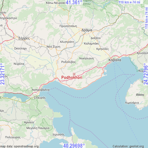
Podhokhóri GPS coordinates[2]
40° 49' 52.032" North, 24° 1' 29.388" East
| Map corner | latitude | longitude |
|---|---|---|
| Upper-left | 41.361°, | 23.32171° |
| Center: | 40.83112°, | 24.02483° |
| Lower-right: | 40.29698°, | 24.72796° |
| Map W x H: | 118.3×118.3 km | = 73.5×73.5mi |
| max Lat: | 41.72048° ⇑13.5% North |
| Podhokhóri: | 40.83112° |
| min Lat: | ⇓86.5% South 34.8346° |
| min Long | Podhokhóri | max Long |
| 19.40494° | 24.02483° | 29.59361° |
| W 79.3%⇐ | ⇒20.7% E |
Elevation
Elevation of Podhokhóri is 270 m = 886 ft, and this is 101.1 m = 332 ft above average elevation for this country.
| Max E: |
1439 m = 4721 ft | 20.6% |
| Podhokhóri | 270 m 886 ft | |
| Avg. | 168.9 m = 554 ft | |
Min E: |
0 m = 0 ft | 79.4% |
See also: Greece elevation on elevation.city.
Geographical zone
Podhokhóri is located in North temperate zone (between Tropic of Cancer and the Arctic Circle). Distance of this Northern Tropic circle is 1934.1 km =1201.8 mi to South.| Distance of | km | miles | from Podhokhóri |
|---|---|---|---|
| North Pole | 5467.1 | 3397.1 | to North |
| Arctic Circle | 2861.2 | 1777.9 | to North |
| Tropic Cancer | 1934.1 | 1201.8 | to South |
| Equator | 4540 | 2821 | to South |


Nearby cities:
15 places around Podhokhóri: (largest is in red/bold)
• Akropótamos
4.7 km =2.9 mi,  169°
169°
• Avlí
13.8 km =8.6 mi,  70°
70°
• Foliá
11.4 km =7.1 mi,  102°
102°
• Karianí
9.6 km =6 mi,  201°
201°
• Mavrólofos
15.8 km =9.8 mi,  305°
305°
• Mousthéni
8.2 km =5.1 mi,  64°
64°
• Nikísiani
16.3 km =10.1 mi,  37°
37°
• Néa Kerdýlia
15.9 km =9.9 mi,  255°
255°
• Ofrínion
10.3 km =6.4 mi,  248°
248°
• Orfánio
8.7 km =5.4 mi,  225°
225°
• Palaiokómi
11.3 km =7 mi,  292°
292°
• Paralía Ofryníou
12.7 km =7.9 mi,  235°
235°
• Platanótopos
3.5 km =2.2 mi, 58°
• Próti
12.7 km =7.9 mi,  351°
351°
• Rodolívos
10.8 km =6.7 mi,  337°
337°
Sources, notices
• [Note1] Compared only with cities in Greece existing in our database
• [Src1] Map data: © OpenStreetMap contributors (CC-BY-SA)
• [Src2] Other city data from geonames.org with taken over terms of usage.
• [Src3] Geographical zone / Annual Mean Temperature by Robert A. Rohde @ Wikipedia
