Rodolívos geodata
Rodolívos (Central Macedonia) is a seat of a third-order administrative division; located in Greece in Europe/Athens (GMT+3) time zone. With population of 2,072 people, there are 502 cities with bigger population in this country. Compared to other cities in Greece, 89.1% of cities are located further ↓South; 77.9% of cities are located further ←West and 83.8% of cities have lower elevation than Rodolívos. Note1
Administrative division(s):
- Level 1: Central Macedonia
- Level 2: Nomós Serrón
- Level 3: Dimos Amfipoli


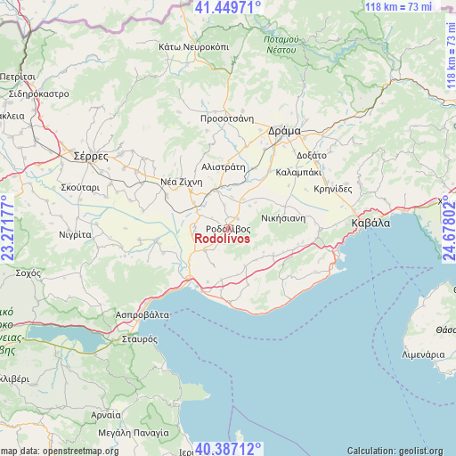
Rodolívos GPS coordinates[2]
40° 55' 13.98" North, 23° 58' 29.604" East
| Map corner | latitude | longitude |
|---|---|---|
| Upper-left | 41.44971°, | 23.27177° |
| Center: | 40.92055°, | 23.97489° |
| Lower-right: | 40.38712°, | 24.67802° |
| Map W x H: | 118.1×118.1 km | = 73.4×73.4mi |
| max Lat: | 41.72048° ⇑10.9% North |
| Rodolívos: | 40.92055° |
| min Lat: | ⇓89.1% South 34.8346° |
| min Long | Rodolívos | max Long |
| 19.40494° | 23.97489° | 29.59361° |
| W 77.9%⇐ | ⇒22.1% E |
Elevation
Elevation of Rodolívos is 353 m = 1158 ft, and this is 184.1 m = 604 ft above average elevation for this country.
| Max E: |
1439 m = 4721 ft | 16.2% |
| Rodolívos | 353 m 1158 ft | |
| Avg. | 168.9 m = 554 ft | |
Min E: |
0 m = 0 ft | 83.8% |
See also: Greece elevation on elevation.city.
Geographical zone
Rodolívos is located in North temperate zone (between Tropic of Cancer and the Arctic Circle). Distance of this Northern Tropic circle is 1944 km =1207.9 mi to South.| Distance of | km | miles | from Rodolívos |
|---|---|---|---|
| North Pole | 5457.1 | 3390.9 | to North |
| Arctic Circle | 2851.2 | 1771.7 | to North |
| Tropic Cancer | 1944 | 1207.9 | to South |
| Equator | 4549.9 | 2827.2 | to South |


Nearby cities:
15 places around Rodolívos: (largest is in red/bold)
• Akropótamos
15.5 km =9.6 mi,  160°
160°
• Alistráti
16.1 km =10 mi,  354°
354°
• Dravískos
8.7 km =5.4 mi,  272°
272°
• Georgianí
15.1 km =9.4 mi,  74°
74°
• Kormísta
9.5 km =5.9 mi,  45°
45°
• Krinída
8.3 km =5.2 mi,  5°
5°
• Mavrólofos
8.8 km =5.5 mi,  264°
264°
• Mousthéni
13.3 km =8.3 mi,  119°
119°
• Nikísiani
14.4 km =8.9 mi,  78°
78°
• Néa Báfra
8.5 km =5.3 mi,  26°
26°
• Ofrínion
14.8 km =9.2 mi,  201°
201°
• Palaiokómi
8.3 km =5.2 mi,  228°
228°
• Platanótopos
10.9 km =6.8 mi,  138°
138°
• Podhokhóri
10.8 km =6.7 mi, 157°
• Próti
3.4 km =2.1 mi,  40°
40°
Sources, notices
• [Note1] Compared only with cities in Greece existing in our database
• [Src1] Map data: © OpenStreetMap contributors (CC-BY-SA)
• [Src2] Other city data from geonames.org with taken over terms of usage.
• [Src3] Geographical zone / Annual Mean Temperature by Robert A. Rohde @ Wikipedia
