Aréthousa geodata
Aréthousa (Central Macedonia) is a populated place; located in Greece in Europe/Athens (GMT+3) time zone. With population of 905 people, there are 1126 cities with bigger population in this country. Compared to other cities in Greece, 82.8% of cities are located further ↓South; 66.1% of cities are located further ←West and 83.9% of cities have lower elevation than Aréthousa. Note1
Administrative division(s):
- Level 1: Central Macedonia
- Level 2: Nomós Thessaloníkis
- Level 3: Dimos Volvi


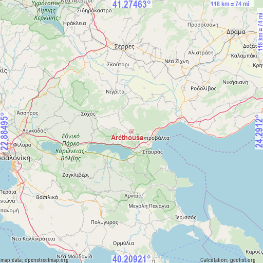
Aréthousa GPS coordinates[2]
40° 44' 38.58" North, 23° 35' 17.052" East
| Map corner | latitude | longitude |
|---|---|---|
| Upper-left | 41.27463°, | 22.88495° |
| Center: | 40.74405°, | 23.58807° |
| Lower-right: | 40.20921°, | 24.2912° |
| Map W x H: | 118.5×118.5 km | = 73.6×73.6mi |
| max Lat: | 41.72048° ⇑17.2% North |
| Aréthousa: | 40.74405° |
| min Lat: | ⇓82.8% South 34.8346° |
| min Long | Aréthousa | max Long |
| 19.40494° | 23.58807° | 29.59361° |
| W 66.1%⇐ | ⇒33.9% E |
Elevation
Elevation of Aréthousa is 356 m = 1168 ft, and this is 187.1 m = 614 ft above average elevation for this country.
| Max E: |
1439 m = 4721 ft | 16.1% |
| Aréthousa | 356 m 1168 ft | |
| Avg. | 168.9 m = 554 ft | |
Min E: |
0 m = 0 ft | 83.9% |
See also: Greece elevation on elevation.city.
Geographical zone
Aréthousa is located in North temperate zone (between Tropic of Cancer and the Arctic Circle). Distance of this Northern Tropic circle is 1924.4 km =1195.8 mi to South.| Distance of | km | miles | from Aréthousa |
|---|---|---|---|
| North Pole | 5476.7 | 3403.1 | to North |
| Arctic Circle | 2870.9 | 1783.9 | to North |
| Tropic Cancer | 1924.4 | 1195.8 | to South |
| Equator | 4530.3 | 2815 | to South |


Nearby cities:
15 places around Aréthousa: (largest is in red/bold)
• Achinós
20.4 km =12.7 mi,  16°
16°
• Askós
16.9 km =10.5 mi,  272°
272°
• Asproválta
10.5 km =6.5 mi,  98°
98°
• Efkarpía
20.3 km =12.6 mi,  49°
49°
• Flámpouro
20.9 km =13 mi,  355°
355°
• Mavrothálassa
21.6 km =13.4 mi,  39°
39°
• Nigríta
19.4 km =12.1 mi,  337°
337°
• Néa Apollonía
18.1 km =11.2 mi,  223°
223°
• Néa Vrasná
10.2 km =6.3 mi,  114°
114°
• Sitochóri
15.5 km =9.6 mi,  9°
9°
• Sochós
21.2 km =13.2 mi,  292°
292°
• Stavrós
12.9 km =8 mi,  132°
132°
• Terpní
21.2 km =13.2 mi,  334°
334°
• Varvára
20.3 km =12.6 mi,  162°
162°
• Ívira
19.2 km =11.9 mi,  28°
28°
Sources, notices
• [Note1] Compared only with cities in Greece existing in our database
• [Src1] Map data: © OpenStreetMap contributors (CC-BY-SA)
• [Src2] Other city data from geonames.org with taken over terms of usage.
• [Src3] Geographical zone / Annual Mean Temperature by Robert A. Rohde @ Wikipedia
