Santa Catarina Ixtahuacán geodata
Santa Catarina Ixtahuacán (Sololá) is a seat of a second-order administrative division; located in Guatemala in America/Guatemala (GMT-6) time zone. With population of 14,734 people, there are 83 cities with bigger population in this country. Compared to other cities in Guatemala, 50.1% of cities are located further ↑North; 65.2% of cities are located further →East and 83.2% of cities have lower elevation than Santa Catarina Ixtahuacán. Note1
Current local time in Santa Catarina Ixtahuacán:
01:58 PM, SundayDifference from your time zone: hours


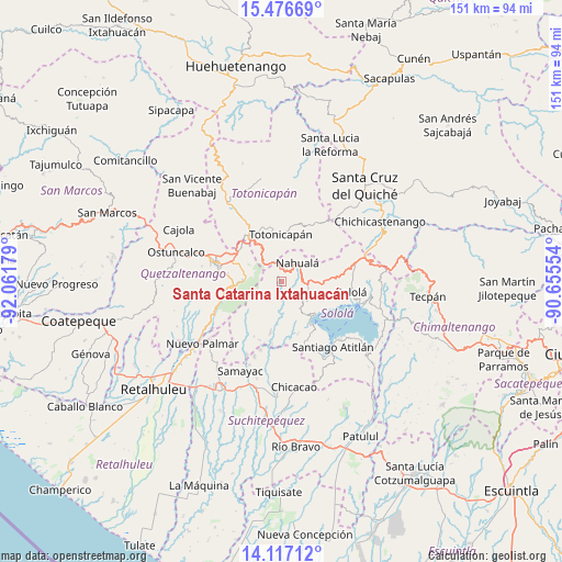
Santa Catarina Ixtahuacán GPS coordinates[2]
14° 47' 52.692" North, 91° 21' 31.176" West
| Map corner | latitude | longitude |
|---|---|---|
| Upper-left | 15.47669°, | -92.06179° |
| Center: | 14.79797°, | -91.35866° |
| Lower-right: | 14.11712°, | -90.65554° |
| Map W x H: | 151.2×151.2 km | = 94×94mi |
| max Lat: | 17.06606° ⇑50.1% North |
| Santa Catarina Ixtahuacán: | 14.79797° |
| min Lat: | ⇓49.9% South 13.9274° |
| min Long | Santa Catarina | max Long |
| -92.19298° | -91.35866° | -88.59444° |
| W 34.8%⇐ | ⇒65.2% E |
Elevation
Elevation of Santa Catarina Ixtahuacán is 2198 m = 7211 ft, and this is 931 m = 3054 ft above average elevation for this country.
| Max E: |
3254 m = 10676 ft | 16.8% |
| Santa Catarina Ixtahuacán | 2198 m 7211 ft | |
| Avg. | 1267 m = 4157 ft | |
Min E: |
1 m = 3 ft | 83.2% |
See also: Guatemala elevation on elevation.city.
Geographical zone
Santa Catarina Ixtahuacán is located in North Torrid zone (between Equator and Tropic of Cancer). Distance of this Northern Tropic circle is 960.5 km =596.8 mi to North.| Distance of | km | miles | from Santa Catarina Ixtahuacán |
|---|---|---|---|
| North Pole | 8361.7 | 5195.7 | to North |
| Arctic Circle | 5755.8 | 3576.5 | to North |
| Tropic Cancer | 960.5 | 596.8 | to North |
| Equator | 1645.4 | 1022.4 | to South |


Nearby cities:
15 places around Santa Catarina Ixtahuacán: (largest is in red/bold)
• Almolonga
14.8 km =9.2 mi,  277°
277°
• Cantel
10.5 km =6.5 mi, 278°
• Nahualá
6.6 km =4.1 mi,  41°
41°
• Salcajá
13.9 km =8.6 mi,  310°
310°
• San Cristóbal Totonicapán
15.9 km =9.9 mi,  326°
326°
• San José Chacayá
15.7 km =9.8 mi,  101°
101°
• San Juan La Laguna
13.9 km =8.6 mi,  146°
146°
• San Marcos La Laguna
13.5 km =8.4 mi,  126°
126°
• San Pablo La Laguna
12.6 km =7.8 mi, 132°
• San Pedro La Laguna
14.9 km =9.3 mi,  141°
141°
• Santa Clara La Laguna
11 km =6.8 mi, 147°
• Santa Lucía Utatlán
10.3 km =6.4 mi,  106°
106°
• Santa María Visitación
10.5 km =6.5 mi, 148°
• Totonicapán
12.6 km =7.8 mi,  358°
358°
• Zunil
13.5 km =8.4 mi,  263°
263°
Sources, notices
• [Note1] Compared only with cities in Guatemala existing in our database
• [Src1] Map data: © OpenStreetMap contributors (CC-BY-SA)
• [Src2] Other city data from geonames.org with taken over terms of usage.
• [Src3] Geographical zone / Annual Mean Temperature by Robert A. Rohde @ Wikipedia
