San Antonio Aguas Calientes geodata
San Antonio Aguas Calientes (Sacatepéquez) is a seat of a second-order administrative division; located in Guatemala in America/Guatemala (GMT-6) time zone. With population of 7,811 people, there are 160 cities with bigger population in this country. Compared to other cities in Guatemala, 76.7% of cities are located further ↑North; 56.9% of cities are located further ←West and 58.7% of cities have lower elevation than San Antonio Aguas Calientes. Note1
Current local time in San Antonio Aguas Calientes:
03:45 PM, SundayDifference from your time zone: hours


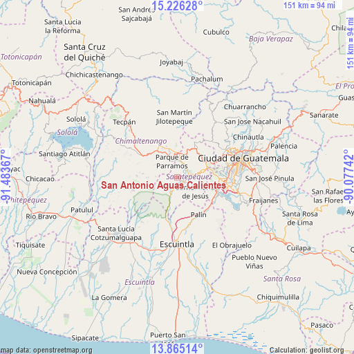
San Antonio Aguas Calientes GPS coordinates[2]
14° 32' 48.336" North, 90° 46' 49.944" West
| Map corner | latitude | longitude |
|---|---|---|
| Upper-left | 15.22628°, | -91.48367° |
| Center: | 14.54676°, | -90.78054° |
| Lower-right: | 13.86514°, | -90.07742° |
| Map W x H: | 151.3×151.3 km | = 94×94mi |
| max Lat: | 17.06606° ⇑76.7% North |
| San Antonio Aguas Calientes: | 14.54676° |
| min Lat: | ⇓23.3% South 13.9274° |
| min Long | San Antonio Agu | max Long |
| -92.19298° | -90.78054° | -88.59444° |
| W 56.9%⇐ | ⇒43.1% E |
Elevation
Elevation of San Antonio Aguas Calientes is 1503 m = 4931 ft, and this is 236 m = 774 ft above average elevation for this country.
| Max E: |
3254 m = 10676 ft | 41.3% |
| San Antonio Aguas Calientes | 1503 m 4931 ft | |
| Avg. | 1267 m = 4157 ft | |
Min E: |
1 m = 3 ft | 58.7% |
See also: Guatemala elevation on elevation.city.
Geographical zone
San Antonio Aguas Calientes is located in North Torrid zone (between Equator and Tropic of Cancer). Distance of this Northern Tropic circle is 988.5 km =614.2 mi to North.| Distance of | km | miles | from San Antonio Aguas Calientes |
|---|---|---|---|
| North Pole | 8389.6 | 5213.1 | to North |
| Arctic Circle | 5783.7 | 3593.8 | to North |
| Tropic Cancer | 988.5 | 614.2 | to North |
| Equator | 1617.4 | 1005 | to South |


Nearby cities:
15 places around San Antonio Aguas Calientes: (largest is in red/bold)
• Alotenango
7.9 km =4.9 mi,  201°
201°
• Antigua Guatemala
5.2 km =3.2 mi,  72°
72°
• Ciudad Vieja
3.2 km =2 mi,  143°
143°
• El Tejar
11.2 km =7 mi,  354°
354°
• Jocotenango
5.8 km =3.6 mi,  52°
52°
• Magdalena Milpas Altas
11.4 km =7.1 mi,  89°
89°
• Parramos
7.3 km =4.5 mi,  340°
340°
• Pastores
6 km =3.7 mi,  27°
27°
• San Andrés Itzapa
10.8 km =6.7 mi,  321°
321°
• San Bartolomé Milpas Altas
12.9 km =8 mi,  58°
58°
• San Miguel Dueñas
3.4 km =2.1 mi,  216°
216°
• Santa Catarina Barahona
0.8 km =0.5 mi,  311°
311°
• Santa Lucía Milpas Altas
11.7 km =7.3 mi, 73°
• Santa María de Jesús
9.5 km =5.9 mi,  127°
127°
• Sumpango
12.1 km =7.5 mi,  24°
24°
Sources, notices
• [Note1] Compared only with cities in Guatemala existing in our database
• [Src1] Map data: © OpenStreetMap contributors (CC-BY-SA)
• [Src2] Other city data from geonames.org with taken over terms of usage.
• [Src3] Geographical zone / Annual Mean Temperature by Robert A. Rohde @ Wikipedia
