Santa Lucía Milpas Altas geodata
Santa Lucía Milpas Altas (Sacatepéquez) is a seat of a second-order administrative division; located in Guatemala in America/Guatemala (GMT-6) time zone. With population of 13,001 people, there are 96 cities with bigger population in this country. Compared to other cities in Guatemala, 74.3% of cities are located further ↑North; 60.8% of cities are located further ←West and 74% of cities have lower elevation than Santa Lucía Milpas Altas. Note1
Current local time in Santa Lucía Milpas Altas:
02:32 PM, SundayDifference from your time zone: hours


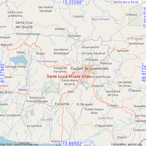
Santa Lucía Milpas Altas GPS coordinates[2]
14° 34' 35.58" North, 90° 40' 34.752" West
| Map corner | latitude | longitude |
|---|---|---|
| Upper-left | 15.25598°, | -91.37945° |
| Center: | 14.57655°, | -90.67632° |
| Lower-right: | 13.89502°, | -89.9732° |
| Map W x H: | 151.3×151.3 km | = 94×94mi |
| max Lat: | 17.06606° ⇑74.3% North |
| Santa Lucía Milpas Altas: | 14.57655° |
| min Lat: | ⇓25.7% South 13.9274° |
| min Long | Santa Lucía Mi | max Long |
| -92.19298° | -90.67632° | -88.59444° |
| W 60.8%⇐ | ⇒39.2% E |
Elevation
Elevation of Santa Lucía Milpas Altas is 1939 m = 6362 ft, and this is 672 m = 2205 ft above average elevation for this country.
| Max E: |
3254 m = 10676 ft | 26% |
| Santa Lucía Milpas Altas | 1939 m 6362 ft | |
| Avg. | 1267 m = 4157 ft | |
Min E: |
1 m = 3 ft | 74% |
See also: Guatemala elevation on elevation.city.
Geographical zone
Santa Lucía Milpas Altas is located in North Torrid zone (between Equator and Tropic of Cancer). Distance of this Northern Tropic circle is 985.2 km =612.2 mi to North.| Distance of | km | miles | from Santa Lucía Milpas Altas |
|---|---|---|---|
| North Pole | 8386.3 | 5211 | to North |
| Arctic Circle | 5780.4 | 3591.8 | to North |
| Tropic Cancer | 985.2 | 612.2 | to North |
| Equator | 1620.8 | 1007.1 | to South |


Nearby cities:
15 places around Santa Lucía Milpas Altas: (largest is in red/bold)
• Amatitlán
11.9 km =7.4 mi,  157°
157°
• Antigua Guatemala
6.5 km =4 mi,  254°
254°
• Ciudad Vieja
11 km =6.8 mi,  237°
237°
• Jocotenango
6.6 km =4.1 mi,  271°
271°
• Magdalena Milpas Altas
3.2 km =2 mi,  176°
176°
• Mixco
9.6 km =6 mi,  51°
51°
• Pastores
8.7 km =5.4 mi,  283°
283°
• San Antonio Aguas Calientes
11.7 km =7.3 mi, 253°
• San Bartolomé Milpas Altas
3.4 km =2.1 mi,  356°
356°
• San Lucas Sacatepéquez
4.3 km =2.7 mi,  28°
28°
• Santa María de Jesús
9.8 km =6.1 mi,  201°
201°
• Santiago Sacatepéquez
6.5 km =4 mi, 359°
• Santo Domingo Xenacoj
11.8 km =7.3 mi,  347°
347°
• Sumpango
9.9 km =6.2 mi,  321°
321°
• Villa Nueva
11.3 km =7 mi,  120°
120°
Sources, notices
• [Note1] Compared only with cities in Guatemala existing in our database
• [Src1] Map data: © OpenStreetMap contributors (CC-BY-SA)
• [Src2] Other city data from geonames.org with taken over terms of usage.
• [Src3] Geographical zone / Annual Mean Temperature by Robert A. Rohde @ Wikipedia
