Nahualá geodata
Nahualá (Sololá) is a seat of a second-order administrative division; located in Guatemala in America/Guatemala (GMT-6) time zone. With population of 27,690 people, there are 41 cities with bigger population in this country. Compared to other cities in Guatemala, 53.1% of cities are located further ↓South; 64.3% of cities are located further →East and 91.7% of cities have lower elevation than Nahualá. Note1


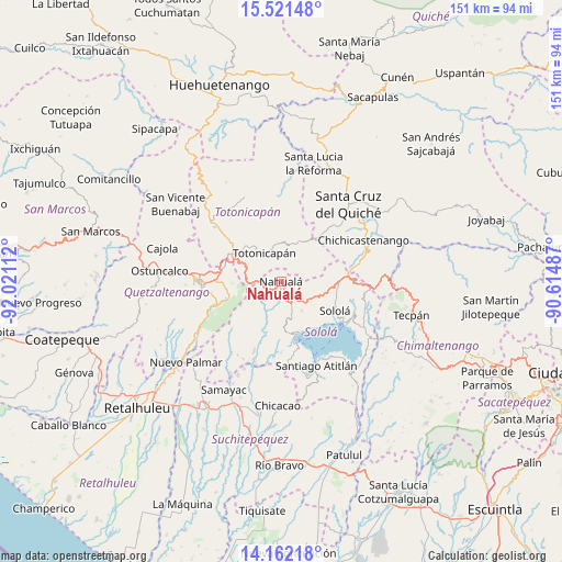
Nahualá GPS coordinates[2]
14° 50' 34.44" North, 91° 19' 4.764" West
| Map corner | latitude | longitude |
|---|---|---|
| Upper-left | 15.52148°, | -92.02112° |
| Center: | 14.8429°, | -91.31799° |
| Lower-right: | 14.16218°, | -90.61487° |
| Map W x H: | 151.1×151.1 km | = 93.9×93.9mi |
| max Lat: | 17.06606° ⇑46.9% North |
| Nahualá: | 14.8429° |
| min Lat: | ⇓53.1% South 13.9274° |
| min Long | Nahualá | max Long |
| -92.19298° | -91.31799° | -88.59444° |
| W 35.7%⇐ | ⇒64.3% E |
Elevation
Elevation of Nahualá is 2482 m = 8143 ft, and this is 1215 m = 3986 ft above average elevation for this country.
| Max E: |
3254 m = 10676 ft | 8.3% |
| Nahualá | 2482 m 8143 ft | |
| Avg. | 1267 m = 4157 ft | |
Min E: |
1 m = 3 ft | 91.7% |
See also: Guatemala elevation on elevation.city.
Geographical zone
Nahualá is located in North Torrid zone (between Equator and Tropic of Cancer). Distance of this Northern Tropic circle is 955.5 km =593.7 mi to North.| Distance of | km | miles | from Nahualá |
|---|---|---|---|
| North Pole | 8356.7 | 5192.6 | to North |
| Arctic Circle | 5750.8 | 3573.4 | to North |
| Tropic Cancer | 955.5 | 593.7 | to North |
| Equator | 1650.4 | 1025.5 | to South |


Nearby cities:
15 places around Nahualá: (largest is in red/bold)
• Cantel
15.2 km =9.4 mi,  256°
256°
• Salcajá
15.5 km =9.6 mi,  285°
285°
• San Cristóbal Totonicapán
15.5 km =9.6 mi,  301°
301°
• San José Chacayá
13.6 km =8.5 mi,  126°
126°
• San Juan La Laguna
16.8 km =10.4 mi,  168°
168°
• San Marcos La Laguna
14.6 km =9.1 mi,  153°
153°
• San Pablo La Laguna
14.4 km =8.9 mi,  160°
160°
• San Pedro La Laguna
17.4 km =10.8 mi, 163°
• Santa Catarina Ixtahuacán
6.6 km =4.1 mi,  221°
221°
• Santa Clara La Laguna
14.3 km =8.9 mi, 173°
• Santa Cruz La Laguna
16.2 km =10.1 mi, 132°
• Santa Lucía Utatlán
9.7 km =6 mi, 145°
• Santa María Visitación
14 km =8.7 mi,  175°
175°
• Sololá
16.5 km =10.3 mi,  118°
118°
• Totonicapán
8.9 km =5.5 mi,  328°
328°
Sources, notices
• [Note1] Compared only with cities in Guatemala existing in our database
• [Src1] Map data: © OpenStreetMap contributors (CC-BY-SA)
• [Src2] Other city data from geonames.org with taken over terms of usage.
• [Src3] Geographical zone / Annual Mean Temperature by Robert A. Rohde @ Wikipedia
