Totonicapán geodata
Totonicapán is a seat of a first-order administrative division; located in Guatemala in America/Guatemala (GMT-6) time zone. With population of 69,734 people, there are 13 cities with bigger population in this country. Compared to other cities in Guatemala, 57.5% of cities are located further ↓South; 65.8% of cities are located further →East and 92.9% of cities have lower elevation than Totonicapán. Note1


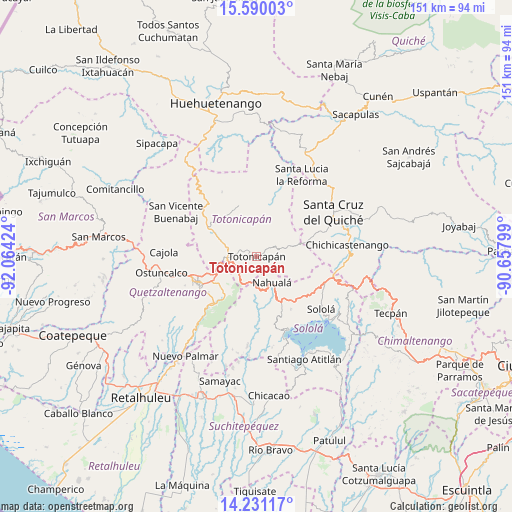
Totonicapán GPS coordinates[2]
14° 54' 42.012" North, 91° 21' 39.996" West
| Map corner | latitude | longitude |
|---|---|---|
| Upper-left | 15.59003°, | -92.06424° |
| Center: | 14.91167°, | -91.36111° |
| Lower-right: | 14.23117°, | -90.65799° |
| Map W x H: | 151.1×151.1 km | = 93.9×93.9mi |
| max Lat: | 17.06606° ⇑42.5% North |
| Totonicapán: | 14.91167° |
| min Lat: | ⇓57.5% South 13.9274° |
| min Long | Totonicapán | max Long |
| -92.19298° | -91.36111° | -88.59444° |
| W 34.2%⇐ | ⇒65.8% E |
Elevation
Elevation of Totonicapán is 2499 m = 8199 ft, and this is 1232 m = 4042 ft above average elevation for this country.
| Max E: |
3254 m = 10676 ft | 7.1% |
| Totonicapán | 2499 m 8199 ft | |
| Avg. | 1267 m = 4157 ft | |
Min E: |
1 m = 3 ft | 92.9% |
See also: Totonicapán elevation on elevation.city.
Geographical zone
Totonicapán is located in North Torrid zone (between Equator and Tropic of Cancer). Distance of this Northern Tropic circle is 947.9 km =589 mi to North.| Distance of | km | miles | from Totonicapán |
|---|---|---|---|
| North Pole | 8349 | 5187.8 | to North |
| Arctic Circle | 5743.2 | 3568.7 | to North |
| Tropic Cancer | 947.9 | 589 | to North |
| Equator | 1658 | 1030.2 | to South |


Nearby cities:
15 places around Totonicapán: (largest is in red/bold)
• Almolonga
17.9 km =11.1 mi,  233°
233°
• Cantel
15.1 km =9.4 mi,  222°
222°
• Momostenango
15.6 km =9.7 mi,  340°
340°
• Nahualá
8.9 km =5.5 mi,  148°
148°
• Olintepeque
16.7 km =10.4 mi,  260°
260°
• Patzité
17.5 km =10.9 mi,  70°
70°
• Quetzaltenango
18.9 km =11.7 mi,  243°
243°
• Salcajá
10.9 km =6.8 mi,  250°
250°
• San Andrés Xecul
13.1 km =8.1 mi,  266°
266°
• San Cristóbal Totonicapán
8.6 km =5.3 mi, 273°
• San Francisco El Alto
9.6 km =6 mi,  292°
292°
• Santa Catarina Ixtahuacán
12.6 km =7.8 mi,  178°
178°
• Santa Lucía Utatlán
18.6 km =11.6 mi, 147°
• Santa María Chiquimula
13.6 km =8.5 mi,  14°
14°
• Zunil
19.3 km =12 mi, 222°
Sources, notices
• [Note1] Compared only with cities in Guatemala existing in our database
• [Src1] Map data: © OpenStreetMap contributors (CC-BY-SA)
• [Src2] Other city data from geonames.org with taken over terms of usage.
• [Src3] Geographical zone / Annual Mean Temperature by Robert A. Rohde @ Wikipedia
