San Agustín geodata
San Agustín (Choluteca) is a populated place; located in Honduras in America/Tegucigalpa (GMT-6) time zone. With population of 938 people, there are 460 cities with bigger population in this country. Compared to other cities in Honduras, 99.2% of cities are located further ↑North; 69.4% of cities are located further ←West and 78.4% of cities have higher elevation than San Agustín. Note1


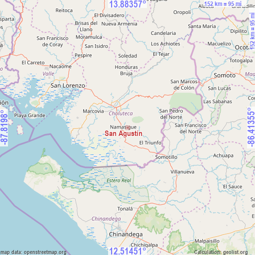
San Agustín GPS coordinates[2]
13° 12' 0" North, 87° 7' 0.012" West
| Map corner | latitude | longitude |
|---|---|---|
| Upper-left | 13.88357°, | -87.8198° |
| Center: | 13.2°, | -87.11667° |
| Lower-right: | 12.51451°, | -86.41355° |
| Map W x H: | 152.2×152.2 km | = 94.6×94.6mi |
| max Lat: | 16.45° ⇑99.2% North |
| San Agustín: | 13.2° |
| min Lat: | ⇓0.8% South 13.11667° |
| min Long | San Agustín | max Long |
| -89.23333° | -87.11667° | -83.23333° |
| W 69.4%⇐ | ⇒30.6% E |
Elevation
Elevation of San Agustín is 96 m = 315 ft, and this is 465.2 m = 1526 ft below average elevation for this country.
| Max E: |
1811 m = 5942 ft | 78.4% |
| Avg. | 561.2 m = 1841 ft | |
| San Agustín | 96 m = 315 ft | |
Min E: |
1 m = 3 ft | 21.6% |
See also: Honduras elevation on elevation.city.
Geographical zone
San Agustín is located in North Torrid zone (between Equator and Tropic of Cancer). Distance of this Northern Tropic circle is 1138.2 km =707.2 mi to North.| Distance of | km | miles | from San Agustín |
|---|---|---|---|
| North Pole | 8539.4 | 5306.1 | to North |
| Arctic Circle | 5933.5 | 3686.9 | to North |
| Tropic Cancer | 1138.2 | 707.2 | to North |
| Equator | 1467.7 | 912 | to South |


Nearby cities:
15 places around San Agustín: (largest is in red/bold)
• Agua Caliente de Linaca
29 km =18 mi,  334°
334°
• Ciudad Choluteca
13.7 km =8.5 mi,  324°
324°
• Concepción de María
12.8 km =8 mi,  81°
81°
• Corpus
13.3 km =8.3 mi,  41°
41°
• El Obraje
5.3 km =3.3 mi,  196°
196°
• El Perico
11.4 km =7.1 mi,  126°
126°
• El Puente
9.3 km =5.8 mi,  0°
0°
• El Triunfo
15.7 km =9.8 mi, 126°
• Los Llanitos
25.5 km =15.8 mi,  292°
292°
• Marcovia
23.1 km =14.4 mi,  295°
295°
• Monjarás
27.9 km =17.3 mi,  270°
270°
• Namasigüe
2.5 km =1.6 mi,  282°
282°
• San Jerónimo
3.4 km =2.1 mi,  219°
219°
• Santa Ana de Yusguare
11.2 km =7 mi, 1°
• Santa Cruz
25.9 km =16.1 mi, 284°
Sources, notices
• [Note1] Compared only with cities in Honduras existing in our database
• [Src1] Map data: © OpenStreetMap contributors (CC-BY-SA)
• [Src2] Other city data from geonames.org with taken over terms of usage.
• [Src3] Geographical zone / Annual Mean Temperature by Robert A. Rohde @ Wikipedia
