Marcala geodata
Marcala (La Paz) is a populated place; located in Honduras in America/Tegucigalpa (GMT-6) time zone. With population of 10,054 people, there are 32 cities with bigger population in this country. Compared to other cities in Honduras, 81.8% of cities are located further ↑North; 69.6% of cities are located further →East and 92.6% of cities have lower elevation than Marcala. Note1


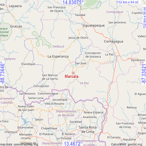
Marcala GPS coordinates[2]
14° 9' 0" North, 88° 1' 59.988" West
| Map corner | latitude | longitude |
|---|---|---|
| Upper-left | 14.83075°, | -88.73646° |
| Center: | 14.15°, | -88.03333° |
| Lower-right: | 13.4672°, | -87.33021° |
| Map W x H: | 151.6×151.6 km | = 94.2×94.2mi |
| max Lat: | 16.45° ⇑81.8% North |
| Marcala: | 14.15° |
| min Lat: | ⇓18.2% South 13.11667° |
| min Long | Marcala | max Long |
| -89.23333° | -88.03333° | -83.23333° |
| W 30.4%⇐ | ⇒69.6% E |
Elevation
Elevation of Marcala is 1248 m = 4094 ft, and this is 686.8 m = 2253 ft above average elevation for this country.
| Max E: |
1811 m = 5942 ft | 7.4% |
| Marcala | 1248 m 4094 ft | |
| Avg. | 561.2 m = 1841 ft | |
Min E: |
1 m = 3 ft | 92.6% |
See also: Honduras elevation on elevation.city.
Geographical zone
Marcala is located in North Torrid zone (between Equator and Tropic of Cancer). Distance of this Northern Tropic circle is 1032.6 km =641.6 mi to North.| Distance of | km | miles | from Marcala |
|---|---|---|---|
| North Pole | 8433.7 | 5240.5 | to North |
| Arctic Circle | 5827.8 | 3621.2 | to North |
| Tropic Cancer | 1032.6 | 641.6 | to North |
| Equator | 1573.3 | 977.6 | to South |


Nearby cities:
15 places around Marcala: (largest is in red/bold)
• Azacualpa
39.9 km =24.8 mi,  288°
288°
• Camasca
41.3 km =25.7 mi,  246°
246°
• Cane
42.2 km =26.2 mi,  69°
69°
• Intibucá
23.5 km =14.6 mi,  322°
322°
• Jesús de Otoro
37.5 km =23.3 mi,  8°
8°
• Jiquinlaca
38 km =23.6 mi,  243°
243°
• La Esperanza
23.9 km =14.9 mi, 318°
• La Florida
10.7 km =6.6 mi,  149°
149°
• La Paz
42.6 km =26.5 mi,  63°
63°
• Los Planes
11.3 km =7 mi,  170°
170°
• San José
14.3 km =8.9 mi,  38°
38°
• San Pedro de Tutule
22.7 km =14.1 mi, 60°
• Santiago Puringla
26.5 km =16.5 mi,  32°
32°
• Tepanguare
36.7 km =22.8 mi, 56°
• Yamaranguila
27.7 km =17.2 mi,  302°
302°
Sources, notices
• [Note1] Compared only with cities in Honduras existing in our database
• [Src1] Map data: © OpenStreetMap contributors (CC-BY-SA)
• [Src2] Other city data from geonames.org with taken over terms of usage.
• [Src3] Geographical zone / Annual Mean Temperature by Robert A. Rohde @ Wikipedia
