Jiquinlaca geodata
Jiquinlaca (Intibucá) is a populated place; located in Honduras in America/Tegucigalpa (GMT-6) time zone. With population of 1,248 people, there are 309 cities with bigger population in this country. Compared to other cities in Honduras, 87.6% of cities are located further ↑North; 79.4% of cities are located further →East and 51% of cities have higher elevation than Jiquinlaca. Note1


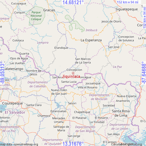
Jiquinlaca GPS coordinates[2]
14° 0' 0" North, 88° 21' 0" West
| Map corner | latitude | longitude |
|---|---|---|
| Upper-left | 14.68121°, | -89.05313° |
| Center: | 14°, | -88.35° |
| Lower-right: | 13.31676°, | -87.64688° |
| Map W x H: | 151.7×151.7 km | = 94.3×94.3mi |
| max Lat: | 16.45° ⇑87.6% North |
| Jiquinlaca: | 14° |
| min Lat: | ⇓12.4% South 13.11667° |
| min Long | Jiquinlaca | max Long |
| -89.23333° | -88.35° | -83.23333° |
| W 20.6%⇐ | ⇒79.4% E |
Elevation
Elevation of Jiquinlaca is 552 m = 1811 ft, and this is 9.2 m = 30 ft below average elevation for this country.
| Max E: |
1811 m = 5942 ft | 51% |
| Avg. | 561.2 m = 1841 ft | |
| Jiquinlaca | 552 m = 1811 ft | |
Min E: |
1 m = 3 ft | 49% |
See also: Honduras elevation on elevation.city.
Geographical zone
Jiquinlaca is located in North Torrid zone (between Equator and Tropic of Cancer). Distance of this Northern Tropic circle is 1049.3 km =652 mi to North.| Distance of | km | miles | from Jiquinlaca |
|---|---|---|---|
| North Pole | 8450.4 | 5250.8 | to North |
| Arctic Circle | 5844.5 | 3631.6 | to North |
| Tropic Cancer | 1049.3 | 652 | to North |
| Equator | 1556.7 | 967.3 | to South |


Nearby cities:
15 places around Jiquinlaca: (largest is in red/bold)
• Azacualpa
29.9 km =18.6 mi,  353°
353°
• Camasca
3.6 km =2.2 mi,  270°
270°
• El Achiotal
44.1 km =27.4 mi,  282°
282°
• Erandique
28.8 km =17.9 mi,  334°
334°
• Guatemalita
31.6 km =19.6 mi,  294°
294°
• Intibucá
40.4 km =25.1 mi,  29°
29°
• La Esperanza
39.1 km =24.3 mi, 27°
• La Florida
40.2 km =25 mi,  79°
79°
• La Virtud
38.2 km =23.7 mi, 278°
• Los Planes
36.4 km =22.6 mi, 81°
• Magdalena
15.8 km =9.8 mi,  159°
159°
• Marcala
38 km =23.6 mi,  63°
63°
• San José
51.3 km =31.9 mi, 57°
• San Pedro de Tutule
60.7 km =37.7 mi, 62°
• Yamaranguila
33.3 km =20.7 mi,  18°
18°
Sources, notices
• [Note1] Compared only with cities in Honduras existing in our database
• [Src1] Map data: © OpenStreetMap contributors (CC-BY-SA)
• [Src2] Other city data from geonames.org with taken over terms of usage.
• [Src3] Geographical zone / Annual Mean Temperature by Robert A. Rohde @ Wikipedia
