Los Caminos geodata
Los Caminos (Cortés) is a populated place; located in Honduras in America/Tegucigalpa (GMT-6) time zone. With population of 1,146 people, there are 337 cities with bigger population in this country. Compared to other cities in Honduras, 55% of cities are located further ↓South; 65.6% of cities are located further →East and 64.2% of cities have lower elevation than Los Caminos. Note1


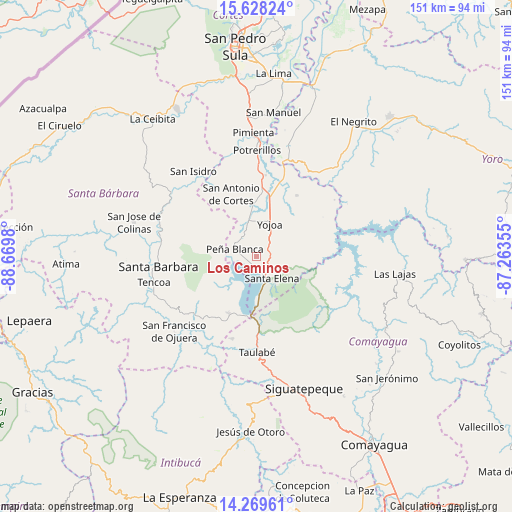
Los Caminos GPS coordinates[2]
14° 57' 0" North, 87° 58' 0.012" West
| Map corner | latitude | longitude |
|---|---|---|
| Upper-left | 15.62824°, | -88.6698° |
| Center: | 14.95°, | -87.96667° |
| Lower-right: | 14.26961°, | -87.26355° |
| Map W x H: | 151.1×151.1 km | = 93.9×93.9mi |
| max Lat: | 16.45° ⇑45% North |
| Los Caminos: | 14.95° |
| min Lat: | ⇓55% South 13.11667° |
| min Long | Los Caminos | max Long |
| -89.23333° | -87.96667° | -83.23333° |
| W 34.4%⇐ | ⇒65.6% E |
Elevation
Elevation of Los Caminos is 724 m = 2375 ft, and this is 162.8 m = 534 ft above average elevation for this country.
| Max E: |
1811 m = 5942 ft | 35.8% |
| Los Caminos | 724 m 2375 ft | |
| Avg. | 561.2 m = 1841 ft | |
Min E: |
1 m = 3 ft | 64.2% |
See also: Honduras elevation on elevation.city.
Geographical zone
Los Caminos is located in North Torrid zone (between Equator and Tropic of Cancer). Distance of this Northern Tropic circle is 943.6 km =586.3 mi to North.| Distance of | km | miles | from Los Caminos |
|---|---|---|---|
| North Pole | 8344.8 | 5185.2 | to North |
| Arctic Circle | 5738.9 | 3566 | to North |
| Tropic Cancer | 943.6 | 586.3 | to North |
| Equator | 1662.3 | 1032.9 | to South |


Nearby cities:
15 places around Los Caminos: (largest is in red/bold)
• Agua Azul
3.7 km =2.3 mi,  180°
180°
• Agua Azul Rancho
5.8 km =3.6 mi,  162°
162°
• Cañaveral
6.5 km =4 mi,  304°
304°
• El Edén
5.4 km =3.4 mi,  270°
270°
• El Mochito
15.6 km =9.7 mi,  233°
233°
• El Tigre
2.6 km =1.6 mi,  223°
223°
• El Zapote
14.6 km =9.1 mi,  59°
59°
• La Guama
8.2 km =5.1 mi,  154°
154°
• Las Vegas, Santa Barbara
14.2 km =8.8 mi, 234°
• Los Naranjos
10.5 km =6.5 mi,  238°
238°
• Oropéndolas
8.2 km =5.1 mi,  25°
25°
• Río Lindo
9.4 km =5.8 mi,  349°
349°
• San Buenaventura
8.2 km =5.1 mi,  334°
334°
• San Francisco de Yojoa
7.4 km =4.6 mi,  0°
0°
• Santa Cruz de Yojoa
8.1 km =5 mi, 62°
Sources, notices
• [Note1] Compared only with cities in Honduras existing in our database
• [Src1] Map data: © OpenStreetMap contributors (CC-BY-SA)
• [Src2] Other city data from geonames.org with taken over terms of usage.
• [Src3] Geographical zone / Annual Mean Temperature by Robert A. Rohde @ Wikipedia
