La Esperanza geodata
La Esperanza (Colón) is a populated place; located in Honduras in America/Tegucigalpa (GMT-6) time zone. With population of 2,014 people, there are 179 cities with bigger population in this country. Compared to other cities in Honduras, 88.8% of cities are located further ↓South; 96.2% of cities are located further ←West and 58% of cities have higher elevation than La Esperanza. Note1


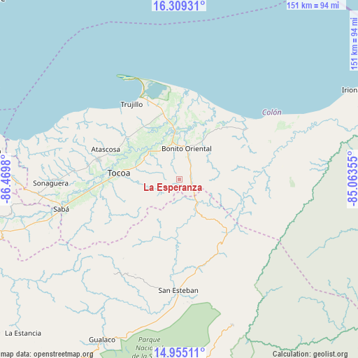
La Esperanza GPS coordinates[2]
15° 37' 59.988" North, 85° 46' 0.012" West
| Map corner | latitude | longitude |
|---|---|---|
| Upper-left | 16.30931°, | -86.4698° |
| Center: | 15.63333°, | -85.76667° |
| Lower-right: | 14.95511°, | -85.06355° |
| Map W x H: | 150.6×150.6 km | = 93.6×93.6mi |
| max Lat: | 16.45° ⇑11.2% North |
| La Esperanza: | 15.63333° |
| min Lat: | ⇓88.8% South 13.11667° |
| min Long | La Esperanza | max Long |
| -89.23333° | -85.76667° | -83.23333° |
| W 96.2%⇐ | ⇒3.8% E |
Elevation
Elevation of La Esperanza is 442 m = 1450 ft, and this is 119.2 m = 391 ft below average elevation for this country.
| Max E: |
1811 m = 5942 ft | 58% |
| Avg. | 561.2 m = 1841 ft | |
| La Esperanza | 442 m = 1450 ft | |
Min E: |
1 m = 3 ft | 42% |
See also: Honduras elevation on elevation.city.
Geographical zone
La Esperanza is located in North Torrid zone (between Equator and Tropic of Cancer). Distance of this Northern Tropic circle is 867.7 km =539.2 mi to North.| Distance of | km | miles | from La Esperanza |
|---|---|---|---|
| North Pole | 8268.8 | 5138 | to North |
| Arctic Circle | 5662.9 | 3518.8 | to North |
| Tropic Cancer | 867.7 | 539.2 | to North |
| Equator | 1738.3 | 1080.1 | to South |


Nearby cities:
15 places around La Esperanza: (largest is in red/bold)
• Bonito Oriental
13.1 km =8.1 mi,  14°
14°
• Corocito
13.1 km =8.1 mi,  352°
352°
• Francia
31.1 km =19.3 mi,  39°
39°
• Jericó
41.2 km =25.6 mi,  328°
328°
• La Brea
28.3 km =17.6 mi,  310°
310°
• La Curva
18.5 km =11.5 mi,  0°
0°
• Prieta
40.1 km =24.9 mi,  261°
261°
• Quebrada de Arena
21.9 km =13.6 mi, 312°
• Salamá
25 km =15.5 mi,  301°
301°
• San Esteban
46.8 km =29.1 mi,  180°
180°
• Santa Rosa de Aguán
35.6 km =22.1 mi, 8°
• Taujica
17.7 km =11 mi,  294°
294°
• Tocoa
25.6 km =15.9 mi,  282°
282°
• Trujillo
37.4 km =23.2 mi, 327°
• Zamora
32.1 km =19.9 mi,  270°
270°
Sources, notices
• [Note1] Compared only with cities in Honduras existing in our database
• [Src1] Map data: © OpenStreetMap contributors (CC-BY-SA)
• [Src2] Other city data from geonames.org with taken over terms of usage.
• [Src3] Geographical zone / Annual Mean Temperature by Robert A. Rohde @ Wikipedia
