French Harbor geodata
French Harbor (Bay Islands) is a populated place; located in Honduras in America/Tegucigalpa (GMT-6) time zone. With population of 2,698 people, there are 129 cities with bigger population in this country. Compared to other cities in Honduras, 99.6% of cities are located further ↓South; 86.4% of cities are located further ←West and 97.4% of cities have higher elevation than French Harbor. Note1


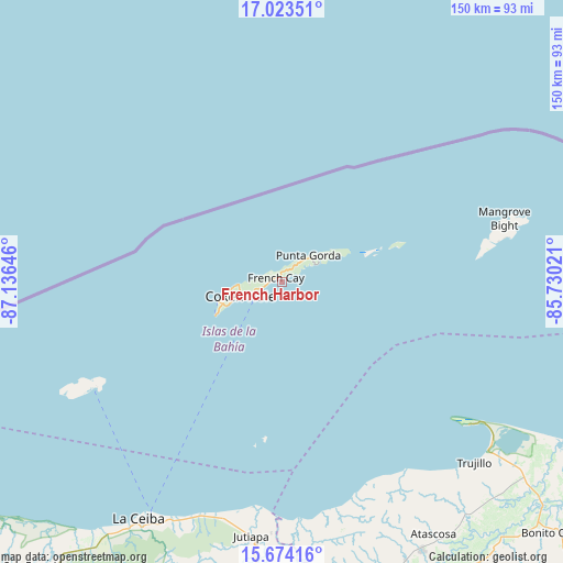
French Harbor GPS coordinates[2]
16° 21' 0" North, 86° 25' 59.988" West
| Map corner | latitude | longitude |
|---|---|---|
| Upper-left | 17.02351°, | -87.13646° |
| Center: | 16.35°, | -86.43333° |
| Lower-right: | 15.67416°, | -85.73021° |
| Map W x H: | 150×150 km | = 93.2×93.2mi |
| max Lat: | 16.45° ⇑0.4% North |
| French Harbor: | 16.35° |
| min Lat: | ⇓99.6% South 13.11667° |
| min Long | French Harbor | max Long |
| -89.23333° | -86.43333° | -83.23333° |
| W 86.4%⇐ | ⇒13.6% E |
Elevation
Elevation of French Harbor is 7 m = 23 ft, and this is 554.2 m = 1818 ft below average elevation for this country.
| Max E: |
1811 m = 5942 ft | 97.4% |
| Avg. | 561.2 m = 1841 ft | |
| French Harbor | 7 m = 23 ft | |
Min E: |
1 m = 3 ft | 2.6% |
See also: Honduras elevation on elevation.city.
Geographical zone
French Harbor is located in North Torrid zone (between Equator and Tropic of Cancer). Distance of this Northern Tropic circle is 788 km =489.6 mi to North.| Distance of | km | miles | from French Harbor |
|---|---|---|---|
| North Pole | 8189.1 | 5088.5 | to North |
| Arctic Circle | 5583.2 | 3469.2 | to North |
| Tropic Cancer | 788 | 489.6 | to North |
| Equator | 1817.9 | 1129.6 | to South |


Nearby cities:
15 places around French Harbor: (largest is in red/bold)
• Corozal
68.2 km =42.4 mi,  206°
206°
• Coxen Hole
11.7 km =7.3 mi,  252°
252°
• Guanaja
58.5 km =36.4 mi,  79°
79°
• Jericó
66.8 km =41.5 mi,  131°
131°
• Jutiapa
65.5 km =40.7 mi,  187°
187°
• La Brea
78.9 km =49 mi,  140°
140°
• La Ceiba
75.5 km =46.9 mi, 209°
• Nueva Armenia
62 km =38.5 mi, 186°
• Piedras Amarillas
75.5 km =46.9 mi, 190°
• Puerto Castilla
62.1 km =38.6 mi, 126°
• Río Esteban
59.2 km =36.8 mi,  166°
166°
• Sambo Creek
65 km =40.4 mi,  204°
204°
• Sandy Bay
14.2 km =8.8 mi,  260°
260°
• Savannah Bight
63.2 km =39.3 mi, 79°
• Trujillo
70.3 km =43.7 mi, 133°
Sources, notices
• [Note1] Compared only with cities in Honduras existing in our database
• [Src1] Map data: © OpenStreetMap contributors (CC-BY-SA)
• [Src2] Other city data from geonames.org with taken over terms of usage.
• [Src3] Geographical zone / Annual Mean Temperature by Robert A. Rohde @ Wikipedia
