Coxen Hole geodata
Coxen Hole (Bay Islands) is a seat of a first-order administrative division; located in Honduras in America/Tegucigalpa (GMT-6) time zone. With population of 7,514 people, there are 42 cities with bigger population in this country. Compared to other cities in Honduras, 99.2% of cities are located further ↓South; 85.2% of cities are located further ←West and 96.8% of cities have higher elevation than Coxen Hole. Note1


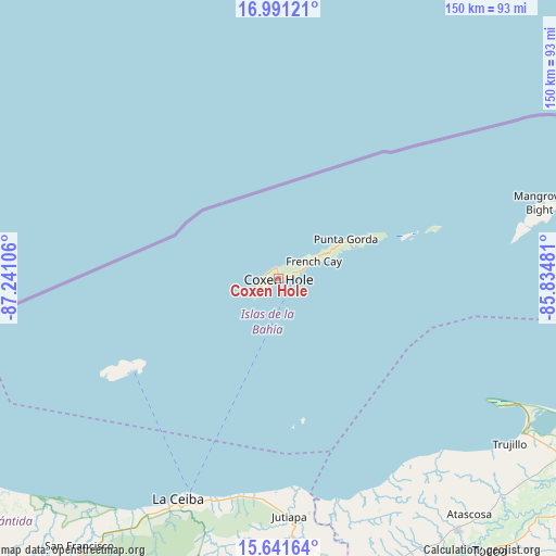
Coxen Hole GPS coordinates[2]
16° 19' 3.324" North, 86° 32' 16.548" West
| Map corner | latitude | longitude |
|---|---|---|
| Upper-left | 16.99121°, | -87.24106° |
| Center: | 16.31759°, | -86.53793° |
| Lower-right: | 15.64164°, | -85.83481° |
| Map W x H: | 150.1×150.1 km | = 93.3×93.3mi |
| max Lat: | 16.45° ⇑0.8% North |
| Coxen Hole: | 16.31759° |
| min Lat: | ⇓99.2% South 13.11667° |
| min Long | Coxen Hole | max Long |
| -89.23333° | -86.53793° | -83.23333° |
| W 85.2%⇐ | ⇒14.8% E |
Elevation
Elevation of Coxen Hole is 8 m = 26 ft, and this is 553.2 m = 1815 ft below average elevation for this country.
| Max E: |
1811 m = 5942 ft | 96.8% |
| Avg. | 561.2 m = 1841 ft | |
| Coxen Hole | 8 m = 26 ft | |
Min E: |
1 m = 3 ft | 3.2% |
See also: Honduras elevation on elevation.city.
Geographical zone
Coxen Hole is located in North Torrid zone (between Equator and Tropic of Cancer). Distance of this Northern Tropic circle is 791.6 km =491.9 mi to North.| Distance of | km | miles | from Coxen Hole |
|---|---|---|---|
| North Pole | 8192.7 | 5090.7 | to North |
| Arctic Circle | 5586.8 | 3471.5 | to North |
| Tropic Cancer | 791.6 | 491.9 | to North |
| Equator | 1814.3 | 1127.4 | to South |


Nearby cities:
15 places around Coxen Hole: (largest is in red/bold)
• Corozal
60.6 km =37.7 mi,  198°
198°
• El Porvenir
75.9 km =47.2 mi,  213°
213°
• French Harbor
11.7 km =7.3 mi,  72°
72°
• Guanaja
70.2 km =43.6 mi,  78°
78°
• Jericó
73.4 km =45.6 mi,  123°
123°
• Jutiapa
61.3 km =38.1 mi,  177°
177°
• La Ceiba
67.3 km =41.8 mi, 202°
• Nueva Armenia
58.2 km =36.2 mi, 175°
• Piedras Amarillas
70.6 km =43.9 mi, 182°
• Puerto Castilla
69.6 km =43.2 mi, 118°
• Río Esteban
59.5 km =37 mi,  154°
154°
• Sambo Creek
57.8 km =35.9 mi, 195°
• Sandy Bay
3.1 km =1.9 mi,  294°
294°
• Savannah Bight
74.8 km =46.5 mi, 78°
• Trujillo
76.7 km =47.7 mi,  125°
125°
Sources, notices
• [Note1] Compared only with cities in Honduras existing in our database
• [Src1] Map data: © OpenStreetMap contributors (CC-BY-SA)
• [Src2] Other city data from geonames.org with taken over terms of usage.
• [Src3] Geographical zone / Annual Mean Temperature by Robert A. Rohde @ Wikipedia
