El Guantillo geodata
El Guantillo (Francisco Morazán) is a populated place; located in Honduras in America/Tegucigalpa (GMT-6) time zone. With population of 1,223 people, there are 315 cities with bigger population in this country. Compared to other cities in Honduras, 66.8% of cities are located further ↑North; 61.8% of cities are located further ←West and 80.8% of cities have lower elevation than El Guantillo. Note1


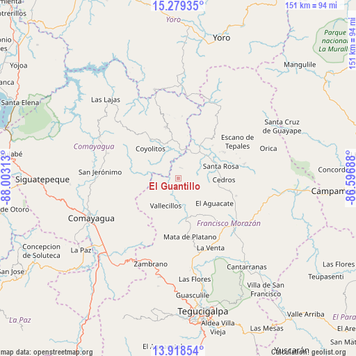
El Guantillo GPS coordinates[2]
14° 36' 0" North, 87° 18' 0" West
| Map corner | latitude | longitude |
|---|---|---|
| Upper-left | 15.27935°, | -88.00313° |
| Center: | 14.6°, | -87.3° |
| Lower-right: | 13.91854°, | -86.59688° |
| Map W x H: | 151.3×151.3 km | = 94×94mi |
| max Lat: | 16.45° ⇑66.8% North |
| El Guantillo: | 14.6° |
| min Lat: | ⇓33.2% South 13.11667° |
| min Long | El Guantillo | max Long |
| -89.23333° | -87.3° | -83.23333° |
| W 61.8%⇐ | ⇒38.2% E |
Elevation
Elevation of El Guantillo is 938 m = 3077 ft, and this is 376.8 m = 1236 ft above average elevation for this country.
| Max E: |
1811 m = 5942 ft | 19.2% |
| El Guantillo | 938 m 3077 ft | |
| Avg. | 561.2 m = 1841 ft | |
Min E: |
1 m = 3 ft | 80.8% |
See also: Honduras elevation on elevation.city.
Geographical zone
El Guantillo is located in North Torrid zone (between Equator and Tropic of Cancer). Distance of this Northern Tropic circle is 982.6 km =610.6 mi to North.| Distance of | km | miles | from El Guantillo |
|---|---|---|---|
| North Pole | 8383.7 | 5209.4 | to North |
| Arctic Circle | 5777.8 | 3590.2 | to North |
| Tropic Cancer | 982.6 | 610.6 | to North |
| Equator | 1623.4 | 1008.7 | to South |


Nearby cities:
15 places around El Guantillo: (largest is in red/bold)
• Agalteca
17.1 km =10.6 mi,  167°
167°
• Cedros
19.7 km =12.2 mi,  90°
90°
• El Escanito
22.8 km =14.2 mi,  70°
70°
• El Guante
22.2 km =13.8 mi,  104°
104°
• El Pedernal
22.6 km =14 mi,  60°
60°
• El Rancho
23.4 km =14.5 mi,  293°
293°
• El Suyatal
12.9 km =8 mi,  135°
135°
• Esquías
16.5 km =10.3 mi,  334°
334°
• Mata de Plátano
1.8 km =1.1 mi, 90°
• Minas de Oro
22.9 km =14.2 mi,  346°
346°
• Pueblo Nuevo
24.2 km =15 mi,  175°
175°
• Quebradas
12.4 km =7.7 mi,  205°
205°
• San Luis
20.9 km =13 mi,  323°
323°
• San Nicolás
14 km =8.7 mi,  337°
337°
• Vallecillo
14.2 km =8.8 mi,  229°
229°
Sources, notices
• [Note1] Compared only with cities in Honduras existing in our database
• [Src1] Map data: © OpenStreetMap contributors (CC-BY-SA)
• [Src2] Other city data from geonames.org with taken over terms of usage.
• [Src3] Geographical zone / Annual Mean Temperature by Robert A. Rohde @ Wikipedia
