El Buen Pastor geodata
El Buen Pastor (Comayagua) is a populated place; located in Honduras in America/Tegucigalpa (GMT-6) time zone. With population of 942 people, there are 456 cities with bigger population in this country. Compared to other cities in Honduras, 51.2% of cities are located further ↑North; 55.6% of cities are located further →East and 71% of cities have lower elevation than El Buen Pastor. Note1


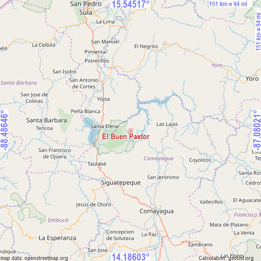
El Buen Pastor GPS coordinates[2]
14° 52' 0.012" North, 87° 46' 59.988" West
| Map corner | latitude | longitude |
|---|---|---|
| Upper-left | 15.54517°, | -88.48646° |
| Center: | 14.86667°, | -87.78333° |
| Lower-right: | 14.18603°, | -87.08021° |
| Map W x H: | 151.1×151.1 km | = 93.9×93.9mi |
| max Lat: | 16.45° ⇑51.2% North |
| El Buen Pastor: | 14.86667° |
| min Lat: | ⇓48.8% South 13.11667° |
| min Long | El Buen Pastor | max Long |
| -89.23333° | -87.78333° | -83.23333° |
| W 44.4%⇐ | ⇒55.6% E |
Elevation
Elevation of El Buen Pastor is 778 m = 2552 ft, and this is 216.8 m = 711 ft above average elevation for this country.
| Max E: |
1811 m = 5942 ft | 29% |
| El Buen Pastor | 778 m 2552 ft | |
| Avg. | 561.2 m = 1841 ft | |
Min E: |
1 m = 3 ft | 71% |
See also: Honduras elevation on elevation.city.
Geographical zone
El Buen Pastor is located in North Torrid zone (between Equator and Tropic of Cancer). Distance of this Northern Tropic circle is 952.9 km =592.1 mi to North.| Distance of | km | miles | from El Buen Pastor |
|---|---|---|---|
| North Pole | 8354 | 5190.9 | to North |
| Arctic Circle | 5748.2 | 3571.8 | to North |
| Tropic Cancer | 952.9 | 592.1 | to North |
| Equator | 1653 | 1027.1 | to South |


Nearby cities:
15 places around El Buen Pastor: (largest is in red/bold)
• Agua Azul
20.5 km =12.7 mi,  285°
285°
• Agua Azul Rancho
18.3 km =11.4 mi,  281°
281°
• Cerro Blanco
22.2 km =13.8 mi,  180°
180°
• El Agua Dulcita
18.9 km =11.7 mi,  169°
169°
• El Rosario
7.6 km =4.7 mi, 166°
• El Tigre
22.7 km =14.1 mi, 289°
• El Zapote
18.2 km =11.3 mi,  336°
336°
• La Guama
16.2 km =10.1 mi, 276°
• La Libertad
22.1 km =13.7 mi,  125°
125°
• La Trinidad
20.9 km =13 mi,  143°
143°
• Las Lajas
9.9 km =6.2 mi,  158°
158°
• Los Caminos
21.8 km =13.5 mi,  295°
295°
• Meámbar
9.4 km =5.8 mi, 169°
• Río Bonito
15.5 km =9.6 mi,  224°
224°
• Santa Cruz de Yojoa
18 km =11.2 mi,  315°
315°
Sources, notices
• [Note1] Compared only with cities in Honduras existing in our database
• [Src1] Map data: © OpenStreetMap contributors (CC-BY-SA)
• [Src2] Other city data from geonames.org with taken over terms of usage.
• [Src3] Geographical zone / Annual Mean Temperature by Robert A. Rohde @ Wikipedia
