Ždala geodata
Ždala (Koprivničko-Križevačka) is a populated place; located in Croatia in Europe/Zagreb (GMT+2) time zone. With population of 583 people, there are 765 cities with bigger population in this country. Compared to other cities in Croatia, 87.3% of cities are located further ↓South; 70.1% of cities are located further ←West and 56.3% of cities have higher elevation than Ždala. Note1


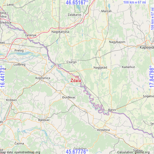
Ždala GPS coordinates[2]
46° 10' 0.732" North, 17° 8' 41.46" East
| Map corner | latitude | longitude |
|---|---|---|
| Upper-left | 46.65167°, | 16.44173° |
| Center: | 46.16687°, | 17.14485° |
| Lower-right: | 45.67776°, | 17.84798° |
| Map W x H: | 108.3×108.3 km | = 67.3×67.3mi |
| max Lat: | 46.52694° ⇑12.7% North |
| Ždala: | 46.16687° |
| min Lat: | ⇓87.3% South 42.54972° |
| min Long | Ždala | max Long |
| 13.52389° | 17.14485° | 19.37694° |
| W 70.1%⇐ | ⇒29.9% E |
Elevation
Elevation of Ždala is 114 m = 374 ft, and this is 39.3 m = 129 ft below average elevation for this country.
| Max E: |
827 m = 2713 ft | 56.3% |
| Avg. | 153.3 m = 503 ft | |
| Ždala | 114 m = 374 ft | |
Min E: |
-1 m = -3 ft | 43.7% |
See also: Croatia elevation on elevation.city.
Geographical zone
Ždala is located in North temperate zone (between Tropic of Cancer and the Arctic Circle). Distance of this North polar circle is 2267.9 km =1409.2 mi to North.| Distance of | km | miles | from Ždala |
|---|---|---|---|
| North Pole | 4873.8 | 3028.4 | to North |
| Arctic Circle | 2267.9 | 1409.2 | to North |
| Tropic Cancer | 2527.4 | 1570.5 | to South |
| Equator | 5133.3 | 3189.7 | to South |


Nearby cities:
15 places around Ždala: (largest is in red/bold)
• Budančevica
20.4 km =12.7 mi,  178°
178°
• Drnje
18.1 km =11.2 mi,  284°
284°
• Ferdinandovac
13.7 km =8.5 mi,  161°
161°
• Gola
7.4 km =4.6 mi,  295°
295°
• Hlebine
14.1 km =8.8 mi,  265°
265°
• Kalinovac
15.4 km =9.6 mi,  188°
188°
• Koprivnički Bregi
18.7 km =11.6 mi,  260°
260°
• Molve
10.8 km =6.7 mi,  233°
233°
• Novigrad Podravski
17.7 km =11 mi,  236°
236°
• Novo Virje
8.4 km =5.2 mi, 176°
• Peteranec
19.7 km =12.2 mi, 278°
• Podravske Sesvete
18.7 km =11.6 mi, 164°
• Sigetec
16.3 km =10.1 mi, 278°
• Virje
16.3 km =10.1 mi, 227°
• Đurđevac
15.1 km =9.4 mi,  202°
202°
Sources, notices
• [Note1] Compared only with cities in Croatia existing in our database
• [Src1] Map data: © OpenStreetMap contributors (CC-BY-SA)
• [Src2] Other city data from geonames.org with taken over terms of usage.
• [Src3] Geographical zone / Annual Mean Temperature by Robert A. Rohde @ Wikipedia
