Zabok geodata
Zabok (Krapinsko-Zagorska) is a seat of a second-order administrative division; located in Croatia in Europe/Zagreb (GMT+2) time zone. With population of 2,873 people, there are 148 cities with bigger population in this country. Compared to other cities in Croatia, 82.7% of cities are located further ↓South; 71.2% of cities are located further →East and 60.6% of cities have lower elevation than Zabok. Note1


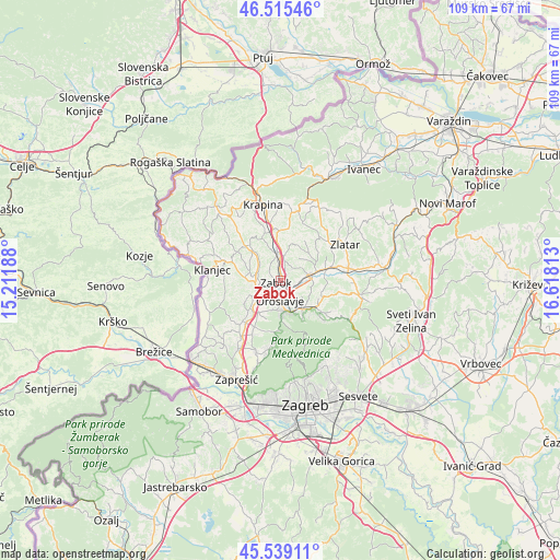
Zabok GPS coordinates[2]
46° 1' 45.984" North, 15° 54' 54" East
| Map corner | latitude | longitude |
|---|---|---|
| Upper-left | 46.51546°, | 15.21188° |
| Center: | 46.02944°, | 15.915° |
| Lower-right: | 45.53911°, | 16.61813° |
| Map W x H: | 108.6×108.6 km | = 67.5×67.5mi |
| max Lat: | 46.52694° ⇑17.3% North |
| Zabok: | 46.02944° |
| min Lat: | ⇓82.7% South 42.54972° |
| min Long | Zabok | max Long |
| 13.52389° | 15.915° | 19.37694° |
| W 28.8%⇐ | ⇒71.2% E |
Elevation
Elevation of Zabok is 146 m = 479 ft, and this is 7.3 m = 24 ft below average elevation for this country.
| Max E: |
827 m = 2713 ft | 39.4% |
| Avg. | 153.3 m = 503 ft | |
| Zabok | 146 m = 479 ft | |
Min E: |
-1 m = -3 ft | 60.6% |
See also: Croatia elevation on elevation.city.
Geographical zone
Zabok is located in North temperate zone (between Tropic of Cancer and the Arctic Circle). Distance of this North polar circle is 2283.2 km =1418.7 mi to North.| Distance of | km | miles | from Zabok |
|---|---|---|---|
| North Pole | 4889.1 | 3037.9 | to North |
| Arctic Circle | 2283.2 | 1418.7 | to North |
| Tropic Cancer | 2512.1 | 1560.9 | to South |
| Equator | 5118 | 3180.2 | to South |


Nearby cities:
15 places around Zabok: (largest is in red/bold)
• Andraševec
5.1 km =3.2 mi,  154°
154°
• Bedekovčina
6.4 km =4 mi,  78°
78°
• Donja Pačetina
7.3 km =4.5 mi,  339°
339°
• Donja Stubica
6.5 km =4 mi,  142°
142°
• Dubrovčan
9.2 km =5.7 mi,  285°
285°
• Igrišće
8.1 km =5 mi,  201°
201°
• Krapinske Toplice
9 km =5.6 mi,  322°
322°
• Oroslavje
3.6 km =2.2 mi,  179°
179°
• Poznanovec
9.1 km =5.7 mi,  74°
74°
• Pustodol
7.6 km =4.7 mi, 152°
• Selnica
10 km =6.2 mi,  92°
92°
• Stubička Slatina
6.7 km =4.2 mi,  208°
208°
• Stubičke Toplice
6.1 km =3.8 mi,  167°
167°
• Sveti Križ Začretje
5.7 km =3.5 mi,  356°
356°
• Veliko Trgovišće
6 km =3.7 mi,  236°
236°
Sources, notices
• [Note1] Compared only with cities in Croatia existing in our database
• [Src1] Map data: © OpenStreetMap contributors (CC-BY-SA)
• [Src2] Other city data from geonames.org with taken over terms of usage.
• [Src3] Geographical zone / Annual Mean Temperature by Robert A. Rohde @ Wikipedia
