Bedekovčina geodata
Bedekovčina (Krapinsko-Zagorska) is a seat of a second-order administrative division; located in Croatia in Europe/Zagreb (GMT+2) time zone. With population of 3,503 people, there are 114 cities with bigger population in this country. Compared to other cities in Croatia, 83.1% of cities are located further ↓South; 68.8% of cities are located further →East and 63.4% of cities have lower elevation than Bedekovčina. Note1


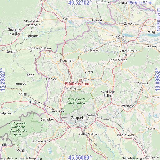
Bedekovčina GPS coordinates[2]
46° 2' 27.996" North, 15° 59' 47.004" East
| Map corner | latitude | longitude |
|---|---|---|
| Upper-left | 46.52702°, | 15.29327° |
| Center: | 46.04111°, | 15.99639° |
| Lower-right: | 45.55089°, | 16.69952° |
| Map W x H: | 108.5×108.5 km | = 67.4×67.4mi |
| max Lat: | 46.52694° ⇑16.9% North |
| Bedekovčina: | 46.04111° |
| min Lat: | ⇓83.1% South 42.54972° |
| min Long | Bedekovčina | max Long |
| 13.52389° | 15.99639° | 19.37694° |
| W 31.2%⇐ | ⇒68.8% E |
Elevation
Elevation of Bedekovčina is 152 m = 499 ft, and this is 1.3 m = 4 ft below average elevation for this country.
| Max E: |
827 m = 2713 ft | 36.6% |
| Avg. | 153.3 m = 503 ft | |
| Bedekovčina | 152 m = 499 ft | |
Min E: |
-1 m = -3 ft | 63.4% |
See also: Croatia elevation on elevation.city.
Geographical zone
Bedekovčina is located in North temperate zone (between Tropic of Cancer and the Arctic Circle). Distance of this North polar circle is 2281.9 km =1417.9 mi to North.| Distance of | km | miles | from Bedekovčina |
|---|---|---|---|
| North Pole | 4887.8 | 3037.1 | to North |
| Arctic Circle | 2281.9 | 1417.9 | to North |
| Tropic Cancer | 2513.4 | 1561.8 | to South |
| Equator | 5119.3 | 3181 | to South |


Nearby cities:
15 places around Bedekovčina: (largest is in red/bold)
• Andraševec
7.2 km =4.5 mi,  214°
214°
• Donja Stubica
6.8 km =4.2 mi,  199°
199°
• Gornja Stubica
7.5 km =4.7 mi,  166°
166°
• Hum Stubički
8.1 km =5 mi,  118°
118°
• Marija Bistrica
9.7 km =6 mi,  113°
113°
• Mače
6.7 km =4.2 mi,  26°
26°
• Oroslavje
8 km =5 mi,  231°
231°
• Poznanovec
2.7 km =1.7 mi,  65°
65°
• Pustodol
8.5 km =5.3 mi, 198°
• Selnica
4.1 km =2.5 mi, 114°
• Stubičke Toplice
8.8 km =5.5 mi, 214°
• Sveti Križ Začretje
7.9 km =4.9 mi,  303°
303°
• Tugonica
8.2 km =5.1 mi,  98°
98°
• Zabok
6.4 km =4 mi,  258°
258°
• Zlatar
8.2 km =5.1 mi,  44°
44°
Sources, notices
• [Note1] Compared only with cities in Croatia existing in our database
• [Src1] Map data: © OpenStreetMap contributors (CC-BY-SA)
• [Src2] Other city data from geonames.org with taken over terms of usage.
• [Src3] Geographical zone / Annual Mean Temperature by Robert A. Rohde @ Wikipedia
