Andraševec geodata
Andraševec (Krapinsko-Zagorska) is a populated place; located in Croatia in Europe/Zagreb (GMT+2) time zone. With population of 859 people, there are 551 cities with bigger population in this country. Compared to other cities in Croatia, 81.5% of cities are located further ↓South; 70.4% of cities are located further →East and 82.9% of cities have lower elevation than Andraševec. Note1


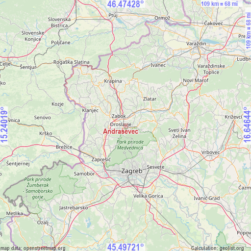
Andraševec GPS coordinates[2]
45° 59' 16.44" North, 15° 56' 35.916" East
| Map corner | latitude | longitude |
|---|---|---|
| Upper-left | 46.47428°, | 15.24019° |
| Center: | 45.9879°, | 15.94331° |
| Lower-right: | 45.49721°, | 16.64644° |
| Map W x H: | 108.6×108.6 km | = 67.5×67.5mi |
| max Lat: | 46.52694° ⇑18.5% North |
| Andraševec: | 45.9879° |
| min Lat: | ⇓81.5% South 42.54972° |
| min Long | Andraševec | max Long |
| 13.52389° | 15.94331° | 19.37694° |
| W 29.6%⇐ | ⇒70.4% E |
Elevation
Elevation of Andraševec is 223 m = 732 ft, and this is 69.7 m = 229 ft above average elevation for this country.
| Max E: |
827 m = 2713 ft | 17.1% |
| Andraševec | 223 m 732 ft | |
| Avg. | 153.3 m = 503 ft | |
Min E: |
-1 m = -3 ft | 82.9% |
See also: Croatia elevation on elevation.city.
Geographical zone
Andraševec is located in North temperate zone (between Tropic of Cancer and the Arctic Circle). Distance of this North polar circle is 2287.8 km =1421.6 mi to North.| Distance of | km | miles | from Andraševec |
|---|---|---|---|
| North Pole | 4893.7 | 3040.8 | to North |
| Arctic Circle | 2287.8 | 1421.6 | to North |
| Tropic Cancer | 2507.5 | 1558.1 | to South |
| Equator | 5113.4 | 3177.3 | to South |


Nearby cities:
15 places around Andraševec: (largest is in red/bold)
• Bedekovčina
7.2 km =4.5 mi,  34°
34°
• Donja Stubica
1.9 km =1.2 mi,  105°
105°
• Gornja Bistra
8.6 km =5.3 mi,  202°
202°
• Gornja Stubica
6 km =3.7 mi,  103°
103°
• Igrišće
5.9 km =3.7 mi,  240°
240°
• Jakovlje
8.9 km =5.5 mi,  229°
229°
• Oroslavje
2.4 km =1.5 mi,  294°
294°
• Poznanovec
9.6 km =6 mi,  43°
43°
• Pustodol
2.5 km =1.6 mi,  147°
147°
• Selnica
8.9 km =5.5 mi,  61°
61°
• Stubička Slatina
5.6 km =3.5 mi,  256°
256°
• Stubičke Toplice
1.6 km =1 mi,  212°
212°
• Sveti Matej
9.8 km =6.1 mi, 103°
• Veliko Trgovišće
7.3 km =4.5 mi,  280°
280°
• Zabok
5.1 km =3.2 mi,  334°
334°
Sources, notices
• [Note1] Compared only with cities in Croatia existing in our database
• [Src1] Map data: © OpenStreetMap contributors (CC-BY-SA)
• [Src2] Other city data from geonames.org with taken over terms of usage.
• [Src3] Geographical zone / Annual Mean Temperature by Robert A. Rohde @ Wikipedia
