Poznanovec geodata
Poznanovec (Krapinsko-Zagorska) is a populated place; located in Croatia in Europe/Zagreb (GMT+2) time zone. With population of 937 people, there are 497 cities with bigger population in this country. Compared to other cities in Croatia, 83.5% of cities are located further ↓South; 68.2% of cities are located further →East and 66.3% of cities have lower elevation than Poznanovec. Note1


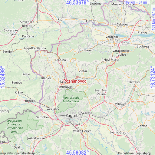
Poznanovec GPS coordinates[2]
46° 3' 3.456" North, 16° 1' 41.196" East
| Map corner | latitude | longitude |
|---|---|---|
| Upper-left | 46.53679°, | 15.32499° |
| Center: | 46.05096°, | 16.02811° |
| Lower-right: | 45.56082°, | 16.73124° |
| Map W x H: | 108.5×108.5 km | = 67.4×67.4mi |
| max Lat: | 46.52694° ⇑16.5% North |
| Poznanovec: | 46.05096° |
| min Lat: | ⇓83.5% South 42.54972° |
| min Long | Poznanovec | max Long |
| 13.52389° | 16.02811° | 19.37694° |
| W 31.8%⇐ | ⇒68.2% E |
Elevation
Elevation of Poznanovec is 157 m = 515 ft, and this is 3.7 m = 12 ft above average elevation for this country.
| Max E: |
827 m = 2713 ft | 33.7% |
| Poznanovec | 157 m 515 ft | |
| Avg. | 153.3 m = 503 ft | |
Min E: |
-1 m = -3 ft | 66.3% |
See also: Croatia elevation on elevation.city.
Geographical zone
Poznanovec is located in North temperate zone (between Tropic of Cancer and the Arctic Circle). Distance of this North polar circle is 2280.8 km =1417.2 mi to North.| Distance of | km | miles | from Poznanovec |
|---|---|---|---|
| North Pole | 4886.7 | 3036.5 | to North |
| Arctic Circle | 2280.8 | 1417.2 | to North |
| Tropic Cancer | 2514.5 | 1562.4 | to South |
| Equator | 5120.4 | 3181.7 | to South |


Nearby cities:
15 places around Poznanovec: (largest is in red/bold)
• Andraševec
9.6 km =6 mi,  223°
223°
• Bedekovčina
2.7 km =1.7 mi,  245°
245°
• Donja Stubica
8.9 km =5.5 mi,  212°
212°
• Gornja Stubica
8.5 km =5.3 mi,  184°
184°
• Hum Stubički
6.8 km =4.2 mi,  136°
136°
• Marija Bistrica
8.1 km =5 mi,  127°
127°
• Mače
4.9 km =3 mi,  6°
6°
• Mihovljan
10.1 km =6.3 mi,  334°
334°
• Pustodol
10.5 km =6.5 mi, 209°
• Selnica
3 km =1.9 mi,  155°
155°
• Sveti Križ Začretje
9.6 km =6 mi,  290°
290°
• Sveti Matej
9.8 km =6.1 mi, 162°
• Tugonica
6.1 km =3.8 mi,  112°
112°
• Zabok
9.1 km =5.7 mi, 254°
• Zlatar
5.8 km =3.6 mi,  34°
34°
Sources, notices
• [Note1] Compared only with cities in Croatia existing in our database
• [Src1] Map data: © OpenStreetMap contributors (CC-BY-SA)
• [Src2] Other city data from geonames.org with taken over terms of usage.
• [Src3] Geographical zone / Annual Mean Temperature by Robert A. Rohde @ Wikipedia
