Vrboska geodata
Vrboska (Split-Dalmatia) is a populated place; located in Croatia in Europe/Zagreb (GMT+2) time zone. With population of 548 people, there are 815 cities with bigger population in this country. Compared to other cities in Croatia, 95.8% of cities are located further ↑North; 59.1% of cities are located further ←West and 97.7% of cities have higher elevation than Vrboska. Note1


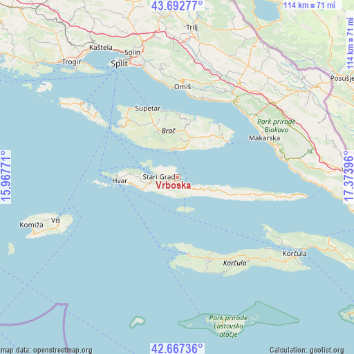
Vrboska GPS coordinates[2]
43° 10' 55.992" North, 16° 40' 14.988" East
| Map corner | latitude | longitude |
|---|---|---|
| Upper-left | 43.69277°, | 15.96771° |
| Center: | 43.18222°, | 16.67083° |
| Lower-right: | 42.66736°, | 17.37396° |
| Map W x H: | 114×114 km | = 70.8×70.8mi |
| max Lat: | 46.52694° ⇑95.8% North |
| Vrboska: | 43.18222° |
| min Lat: | ⇓4.2% South 42.54972° |
| min Long | Vrboska | max Long |
| 13.52389° | 16.67083° | 19.37694° |
| W 59.1%⇐ | ⇒40.9% E |
Elevation
Elevation of Vrboska is 5 m = 16 ft, and this is 148.3 m = 487 ft below average elevation for this country.
| Max E: |
827 m = 2713 ft | 97.7% |
| Avg. | 153.3 m = 503 ft | |
| Vrboska | 5 m = 16 ft | |
Min E: |
-1 m = -3 ft | 2.3% |
See also: Croatia elevation on elevation.city.
Geographical zone
Vrboska is located in North temperate zone (between Tropic of Cancer and the Arctic Circle). Distance of this Northern Tropic circle is 2195.5 km =1364.2 mi to South.| Distance of | km | miles | from Vrboska |
|---|---|---|---|
| North Pole | 5205.6 | 3234.6 | to North |
| Arctic Circle | 2599.8 | 1615.4 | to North |
| Tropic Cancer | 2195.5 | 1364.2 | to South |
| Equator | 4801.4 | 2983.5 | to South |


Nearby cities:
15 places around Vrboska: (largest is in red/bold)
• Blato
28.6 km =17.8 mi,  159°
159°
• Bol
9 km =5.6 mi,  351°
351°
• Hvar
18.5 km =11.5 mi,  266°
266°
• Jelsa
2.9 km =1.8 mi,  142°
142°
• Marina
25.8 km =16 mi,  316°
316°
• Milna
24 km =14.9 mi,  312°
312°
• Nerežišće
18.2 km =11.3 mi,  335°
335°
• Postira
21.7 km =13.5 mi, 351°
• Pučišća
19.1 km =11.9 mi,  15°
15°
• Selca
19.4 km =12.1 mi,  48°
48°
• Stanići
26.2 km =16.3 mi,  10°
10°
• Stari Grad
6.1 km =3.8 mi, 272°
• Supetar
24.5 km =15.2 mi, 336°
• Sutivan
27.5 km =17.1 mi,  325°
325°
• Vela Luka
24.7 km =15.3 mi,  170°
170°
Sources, notices
• [Note1] Compared only with cities in Croatia existing in our database
• [Src1] Map data: © OpenStreetMap contributors (CC-BY-SA)
• [Src2] Other city data from geonames.org with taken over terms of usage.
• [Src3] Geographical zone / Annual Mean Temperature by Robert A. Rohde @ Wikipedia
