Vinkuran geodata
Vinkuran (Istria) is a populated place; located in Croatia in Europe/Zagreb (GMT+2) time zone. With population of 672 people, there are 692 cities with bigger population in this country. Compared to other cities in Croatia, 77.2% of cities are located further ↑North; 97.7% of cities are located further →East and 88.6% of cities have higher elevation than Vinkuran. Note1


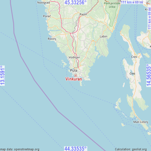
Vinkuran GPS coordinates[2]
44° 50' 9.996" North, 13° 51' 43.992" East
| Map corner | latitude | longitude |
|---|---|---|
| Upper-left | 45.33256°, | 13.1591° |
| Center: | 44.83611°, | 13.86222° |
| Lower-right: | 44.33535°, | 14.56535° |
| Map W x H: | 110.9×110.9 km | = 68.9×68.9mi |
| max Lat: | 46.52694° ⇑77.2% North |
| Vinkuran: | 44.83611° |
| min Lat: | ⇓22.8% South 42.54972° |
| min Long | Vinkuran | max Long |
| 13.52389° | 13.86222° | 19.37694° |
| W 2.3%⇐ | ⇒97.7% E |
Elevation
Elevation of Vinkuran is 29 m = 95 ft, and this is 124.3 m = 408 ft below average elevation for this country.
| Max E: |
827 m = 2713 ft | 88.6% |
| Avg. | 153.3 m = 503 ft | |
| Vinkuran | 29 m = 95 ft | |
Min E: |
-1 m = -3 ft | 11.4% |
See also: Croatia elevation on elevation.city.
Geographical zone
Vinkuran is located in North temperate zone (between Tropic of Cancer and the Arctic Circle). Distance of this Northern Tropic circle is 2379.4 km =1478.5 mi to South.| Distance of | km | miles | from Vinkuran |
|---|---|---|---|
| North Pole | 5021.8 | 3120.4 | to North |
| Arctic Circle | 2415.9 | 1501.2 | to North |
| Tropic Cancer | 2379.4 | 1478.5 | to South |
| Equator | 4985.3 | 3097.7 | to South |


Nearby cities:
15 places around Vinkuran: (largest is in red/bold)
• Bale
23.6 km =14.7 mi,  344°
344°
• Banjole
1.3 km =0.8 mi,  166°
166°
• Barban
28 km =17.4 mi,  25°
25°
• Fažana
11.2 km =7 mi, 335°
• Galižana
10.6 km =6.6 mi,  2°
2°
• Kanfanar
31.8 km =19.8 mi,  356°
356°
• Ližnjan
7.5 km =4.7 mi,  96°
96°
• Loborika
9.4 km =5.8 mi,  21°
21°
• Marčana
15.1 km =9.4 mi, 28°
• Medulin
5.9 km =3.7 mi, 104°
• Premantura
5.4 km =3.4 mi,  137°
137°
• Pula
3.8 km =2.4 mi, 342°
• Svetvinčenat
28.1 km =17.5 mi, 3°
• Valbandon
10 km =6.2 mi, 337°
• Vodnjan
13.7 km =8.5 mi, 356°
Sources, notices
• [Note1] Compared only with cities in Croatia existing in our database
• [Src1] Map data: © OpenStreetMap contributors (CC-BY-SA)
• [Src2] Other city data from geonames.org with taken over terms of usage.
• [Src3] Geographical zone / Annual Mean Temperature by Robert A. Rohde @ Wikipedia
