Pula geodata
Pula (Istria) is a seat of a second-order administrative division; located in Croatia in Europe/Zagreb (GMT+2) time zone. With population of 59,078 people, there are 6 cities with bigger population in this country. Compared to other cities in Croatia, 76.8% of cities are located further ↑North; 97.8% of cities are located further →East and 94.3% of cities have higher elevation than Pula. Note1


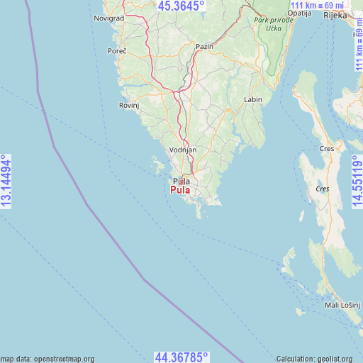
Pula GPS coordinates[2]
44° 52' 5.988" North, 13° 50' 53.016" East
| Map corner | latitude | longitude |
|---|---|---|
| Upper-left | 45.3645°, | 13.14494° |
| Center: | 44.86833°, | 13.84806° |
| Lower-right: | 44.36785°, | 14.55119° |
| Map W x H: | 110.8×110.8 km | = 68.8×68.8mi |
| max Lat: | 46.52694° ⇑76.8% North |
| Pula: | 44.86833° |
| min Lat: | ⇓23.2% South 42.54972° |
| min Long | Pula | max Long |
| 13.52389° | 13.84806° | 19.37694° |
| W 2.2%⇐ | ⇒97.8% E |
Elevation
Elevation of Pula is 11 m = 36 ft, and this is 142.3 m = 467 ft below average elevation for this country.
| Max E: |
827 m = 2713 ft | 94.3% |
| Avg. | 153.3 m = 503 ft | |
| Pula | 11 m = 36 ft | |
Min E: |
-1 m = -3 ft | 5.7% |
See also: Pula elevation on elevation.city.
Geographical zone
Pula is located in North temperate zone (between Tropic of Cancer and the Arctic Circle). Distance of this Northern Tropic circle is 2383 km =1480.7 mi to South.| Distance of | km | miles | from Pula |
|---|---|---|---|
| North Pole | 5018.2 | 3118.2 | to North |
| Arctic Circle | 2412.3 | 1498.9 | to North |
| Tropic Cancer | 2383 | 1480.7 | to South |
| Equator | 4988.9 | 3100 | to South |


Nearby cities:
15 places around Pula: (largest is in red/bold)
• Bale
19.8 km =12.3 mi,  345°
345°
• Banjole
5 km =3.1 mi,  163°
163°
• Barban
25.4 km =15.8 mi,  30°
30°
• Fažana
7.5 km =4.7 mi,  331°
331°
• Galižana
7.2 km =4.5 mi,  12°
12°
• Kanfanar
28.2 km =17.5 mi,  358°
358°
• Ližnjan
9.7 km =6 mi,  117°
117°
• Loborika
6.9 km =4.3 mi,  40°
40°
• Marčana
12.8 km =8 mi, 40°
• Medulin
8.5 km =5.3 mi,  126°
126°
• Premantura
8.9 km =5.5 mi,  147°
147°
• Svetvinčenat
24.6 km =15.3 mi, 6°
• Valbandon
6.2 km =3.9 mi, 334°
• Vinkuran
3.8 km =2.4 mi, 162°
• Vodnjan
10.1 km =6.3 mi,  1°
1°
Sources, notices
• [Note1] Compared only with cities in Croatia existing in our database
• [Src1] Map data: © OpenStreetMap contributors (CC-BY-SA)
• [Src2] Other city data from geonames.org with taken over terms of usage.
• [Src3] Geographical zone / Annual Mean Temperature by Robert A. Rohde @ Wikipedia
