Loborika geodata
Loborika (Istria) is a populated place; located in Croatia in Europe/Zagreb (GMT+2) time zone. With population of 844 people, there are 563 cities with bigger population in this country. Compared to other cities in Croatia, 76.5% of cities are located further ↑North; 97.2% of cities are located further →East and 59.9% of cities have higher elevation than Loborika. Note1


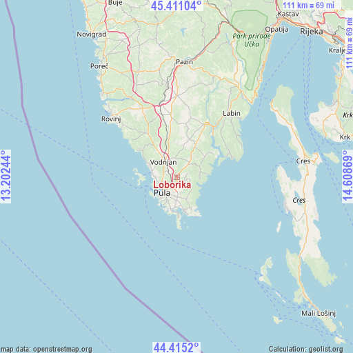
Loborika GPS coordinates[2]
44° 54' 55.008" North, 13° 54' 20.016" East
| Map corner | latitude | longitude |
|---|---|---|
| Upper-left | 45.41104°, | 13.20244° |
| Center: | 44.91528°, | 13.90556° |
| Lower-right: | 44.4152°, | 14.60869° |
| Map W x H: | 110.7×110.7 km | = 68.8×68.8mi |
| max Lat: | 46.52694° ⇑76.5% North |
| Loborika: | 44.91528° |
| min Lat: | ⇓23.5% South 42.54972° |
| min Long | Loborika | max Long |
| 13.52389° | 13.90556° | 19.37694° |
| W 2.8%⇐ | ⇒97.2% E |
Elevation
Elevation of Loborika is 109 m = 358 ft, and this is 44.3 m = 145 ft below average elevation for this country.
| Max E: |
827 m = 2713 ft | 59.9% |
| Avg. | 153.3 m = 503 ft | |
| Loborika | 109 m = 358 ft | |
Min E: |
-1 m = -3 ft | 40.1% |
See also: Croatia elevation on elevation.city.
Geographical zone
Loborika is located in North temperate zone (between Tropic of Cancer and the Arctic Circle). Distance of this Northern Tropic circle is 2388.2 km =1484 mi to South.| Distance of | km | miles | from Loborika |
|---|---|---|---|
| North Pole | 5013 | 3114.9 | to North |
| Arctic Circle | 2407.1 | 1495.7 | to North |
| Tropic Cancer | 2388.2 | 1484 | to South |
| Equator | 4994.1 | 3103.2 | to South |


Nearby cities:
15 places around Loborika: (largest is in red/bold)
• Bale
16.9 km =10.5 mi,  325°
325°
• Banjole
10.5 km =6.5 mi,  197°
197°
• Barban
18.6 km =11.6 mi,  27°
27°
• Fažana
8.1 km =5 mi,  279°
279°
• Galižana
3.4 km =2.1 mi,  302°
302°
• Ližnjan
10.5 km =6.5 mi,  157°
157°
• Marčana
5.9 km =3.7 mi,  40°
40°
• Medulin
10.6 km =6.6 mi,  167°
167°
• Premantura
12.8 km =8 mi,  178°
178°
• Pula
6.9 km =4.3 mi,  220°
220°
• Raša
22.9 km =14.2 mi, 36°
• Svetvinčenat
19.3 km =12 mi,  354°
354°
• Valbandon
7.3 km =4.5 mi,  273°
273°
• Vinkuran
9.4 km =5.8 mi, 201°
• Vodnjan
6.5 km =4 mi,  319°
319°
Sources, notices
• [Note1] Compared only with cities in Croatia existing in our database
• [Src1] Map data: © OpenStreetMap contributors (CC-BY-SA)
• [Src2] Other city data from geonames.org with taken over terms of usage.
• [Src3] Geographical zone / Annual Mean Temperature by Robert A. Rohde @ Wikipedia
