Senj geodata
Senj (Ličko-Senjska) is a seat of a second-order administrative division; located in Croatia in Europe/Zagreb (GMT+2) time zone. With population of 5,518 people, there are 70 cities with bigger population in this country. Compared to other cities in Croatia, 75.4% of cities are located further ↑North; 89.4% of cities are located further →East and 91.1% of cities have higher elevation than Senj. Note1


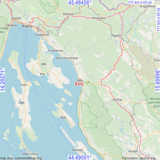
Senj GPS coordinates[2]
44° 59' 21.984" North, 14° 54' 20.988" East
| Map corner | latitude | longitude |
|---|---|---|
| Upper-left | 45.48456°, | 14.20271° |
| Center: | 44.98944°, | 14.90583° |
| Lower-right: | 44.49001°, | 15.60896° |
| Map W x H: | 110.6×110.6 km | = 68.7×68.7mi |
| max Lat: | 46.52694° ⇑75.4% North |
| Senj: | 44.98944° |
| min Lat: | ⇓24.6% South 42.54972° |
| min Long | Senj | max Long |
| 13.52389° | 14.90583° | 19.37694° |
| W 10.6%⇐ | ⇒89.4% E |
Elevation
Elevation of Senj is 18 m = 59 ft, and this is 135.3 m = 444 ft below average elevation for this country.
| Max E: |
827 m = 2713 ft | 91.1% |
| Avg. | 153.3 m = 503 ft | |
| Senj | 18 m = 59 ft | |
Min E: |
-1 m = -3 ft | 8.9% |
See also: Croatia elevation on elevation.city.
Geographical zone
Senj is located in North temperate zone (between Tropic of Cancer and the Arctic Circle). Distance of this Northern Tropic circle is 2396.4 km =1489.1 mi to South.| Distance of | km | miles | from Senj |
|---|---|---|---|
| North Pole | 5004.7 | 3109.8 | to North |
| Arctic Circle | 2398.8 | 1490.5 | to North |
| Tropic Cancer | 2396.4 | 1489.1 | to South |
| Equator | 5002.4 | 3108.3 | to South |


Nearby cities:
15 places around Senj: (largest is in red/bold)
• Baška
12.2 km =7.6 mi,  259°
259°
• Bribir
22.1 km =13.7 mi,  329°
329°
• Brinje
18 km =11.2 mi,  85°
85°
• Crikvenica
26.8 km =16.7 mi,  321°
321°
• Kampor
28 km =17.4 mi,  211°
211°
• Križpolje
20.7 km =12.9 mi,  80°
80°
• Krk
26.3 km =16.3 mi,  279°
279°
• Kuterevo
26 km =16.2 mi,  134°
134°
• Lopar
22.3 km =13.9 mi,  218°
218°
• Mundanije
26.8 km =16.7 mi,  204°
204°
• Novi Vinodolski
17.9 km =11.1 mi, 329°
• Punat
22 km =13.7 mi, 277°
• Selce
23.6 km =14.7 mi, 321°
• Supetarska Draga
25.7 km =16 mi, 213°
• Vrbnik
20.7 km =12.9 mi,  297°
297°
Sources, notices
• [Note1] Compared only with cities in Croatia existing in our database
• [Src1] Map data: © OpenStreetMap contributors (CC-BY-SA)
• [Src2] Other city data from geonames.org with taken over terms of usage.
• [Src3] Geographical zone / Annual Mean Temperature by Robert A. Rohde @ Wikipedia
