Kuterevo geodata
Kuterevo (Ličko-Senjska) is a populated place; located in Croatia in Europe/Zagreb (GMT+2) time zone. With population of 522 people, there are 853 cities with bigger population in this country. Compared to other cities in Croatia, 77.6% of cities are located further ↑North; 88.2% of cities are located further →East and 97.8% of cities have lower elevation than Kuterevo. Note1


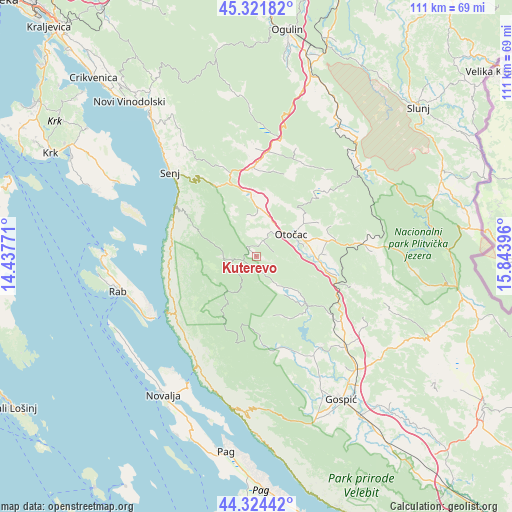
Kuterevo GPS coordinates[2]
44° 49' 31.008" North, 15° 8' 26.988" East
| Map corner | latitude | longitude |
|---|---|---|
| Upper-left | 45.32182°, | 14.43771° |
| Center: | 44.82528°, | 15.14083° |
| Lower-right: | 44.32442°, | 15.84396° |
| Map W x H: | 110.9×110.9 km | = 68.9×68.9mi |
| max Lat: | 46.52694° ⇑77.6% North |
| Kuterevo: | 44.82528° |
| min Lat: | ⇓22.4% South 42.54972° |
| min Long | Kuterevo | max Long |
| 13.52389° | 15.14083° | 19.37694° |
| W 11.8%⇐ | ⇒88.2% E |
Elevation
Elevation of Kuterevo is 560 m = 1837 ft, and this is 406.7 m = 1334 ft above average elevation for this country.
| Max E: |
827 m = 2713 ft | 2.2% |
| Kuterevo | 560 m 1837 ft | |
| Avg. | 153.3 m = 503 ft | |
Min E: |
-1 m = -3 ft | 97.8% |
See also: Croatia elevation on elevation.city.
Geographical zone
Kuterevo is located in North temperate zone (between Tropic of Cancer and the Arctic Circle). Distance of this Northern Tropic circle is 2378.2 km =1477.7 mi to South.| Distance of | km | miles | from Kuterevo |
|---|---|---|---|
| North Pole | 5023 | 3121.1 | to North |
| Arctic Circle | 2417.1 | 1501.9 | to North |
| Tropic Cancer | 2378.2 | 1477.7 | to South |
| Equator | 4984.1 | 3097 | to South |


Nearby cities:
15 places around Kuterevo: (largest is in red/bold)
• Banjol
29.4 km =18.3 mi,  253°
253°
• Brinje
19.7 km =12.2 mi,  358°
358°
• Gornji Prozor
10.4 km =6.5 mi,  79°
79°
• Križpolje
21.9 km =13.6 mi,  5°
5°
• Ličko Lešće
14.7 km =9.1 mi,  98°
98°
• Mundanije
30.5 km =19 mi,  258°
258°
• Otočac
9.1 km =5.7 mi,  57°
57°
• Perušić
27.4 km =17 mi,  135°
135°
• Popovača
20.9 km =13 mi,  171°
171°
• Rab
30.9 km =19.2 mi, 255°
• Saborsko
31.8 km =19.8 mi, 56°
• Senj
26 km =16.2 mi,  314°
314°
• Sinac
15.1 km =9.4 mi,  88°
88°
• Vrhovine
22.1 km =13.7 mi, 82°
• Čovići
12.6 km =7.8 mi, 88°
Sources, notices
• [Note1] Compared only with cities in Croatia existing in our database
• [Src1] Map data: © OpenStreetMap contributors (CC-BY-SA)
• [Src2] Other city data from geonames.org with taken over terms of usage.
• [Src3] Geographical zone / Annual Mean Temperature by Robert A. Rohde @ Wikipedia
