Supetarska Draga geodata
Supetarska Draga (Primorsko-Goranska) is a populated place; located in Croatia in Europe/Zagreb (GMT+2) time zone. With population of 1,099 people, there are 416 cities with bigger population in this country. Compared to other cities in Croatia, 78.1% of cities are located further ↑North; 90.5% of cities are located further →East and 99.8% of cities have higher elevation than Supetarska Draga. Note1


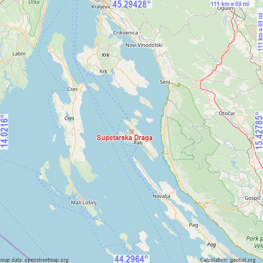
Supetarska Draga GPS coordinates[2]
44° 47' 51" North, 14° 43' 28.992" East
| Map corner | latitude | longitude |
|---|---|---|
| Upper-left | 45.29428°, | 14.0216° |
| Center: | 44.7975°, | 14.72472° |
| Lower-right: | 44.2964°, | 15.42785° |
| Map W x H: | 111×111 km | = 69×69mi |
| max Lat: | 46.52694° ⇑78.1% North |
| Supetarska Draga: | 44.7975° |
| min Lat: | ⇓21.9% South 42.54972° |
| min Long | Supetarska Drag | max Long |
| 13.52389° | 14.72472° | 19.37694° |
| W 9.5%⇐ | ⇒90.5% E |
Elevation
Elevation of Supetarska Draga is 0 m = 0 ft, and this is 153.3 m = 503 ft below average elevation for this country.
| Max E: |
827 m = 2713 ft | 99.8% |
| Avg. | 153.3 m = 503 ft | |
| Supetarska Draga | 0 m = 0 ft | |
Min E: |
-1 m = -3 ft | 0.2% |
See also: Croatia elevation on elevation.city.
Geographical zone
Supetarska Draga is located in North temperate zone (between Tropic of Cancer and the Arctic Circle). Distance of this Northern Tropic circle is 2375.1 km =1475.8 mi to South.| Distance of | km | miles | from Supetarska Draga |
|---|---|---|---|
| North Pole | 5026 | 3123 | to North |
| Arctic Circle | 2420.2 | 1503.8 | to North |
| Tropic Cancer | 2375.1 | 1475.8 | to South |
| Equator | 4981 | 3095 | to South |


Nearby cities:
15 places around Supetarska Draga: (largest is in red/bold)
• Banjol
7 km =4.3 mi,  138°
138°
• Baška
19.3 km =12 mi,  6°
6°
• Cres
30.6 km =19 mi,  306°
306°
• Kampor
2.5 km =1.6 mi,  190°
190°
• Krk
28.1 km =17.5 mi,  335°
335°
• Kuterevo
33 km =20.5 mi,  84°
84°
• Lopar
3.9 km =2.4 mi, 6°
• Mundanije
4.2 km =2.6 mi,  134°
134°
• Novalja
29.6 km =18.4 mi,  154°
154°
• Punat
25.3 km =15.7 mi, 342°
• Rab
5.3 km =3.3 mi, 147°
• Senj
25.7 km =16 mi,  33°
33°
• Veli Lošinj
35.7 km =22.2 mi,  209°
209°
• Vrbnik
31.2 km =19.4 mi,  352°
352°
• Vrh
32 km =19.9 mi,  331°
331°
Sources, notices
• [Note1] Compared only with cities in Croatia existing in our database
• [Src1] Map data: © OpenStreetMap contributors (CC-BY-SA)
• [Src2] Other city data from geonames.org with taken over terms of usage.
• [Src3] Geographical zone / Annual Mean Temperature by Robert A. Rohde @ Wikipedia
