Gornji Prozor geodata
Gornji Prozor (Ličko-Senjska) is a populated place; located in Croatia in Europe/Zagreb (GMT+2) time zone. With population of 940 people, there are 495 cities with bigger population in this country. Compared to other cities in Croatia, 77.1% of cities are located further ↑North; 86.6% of cities are located further →East and 96.6% of cities have lower elevation than Gornji Prozor. Note1


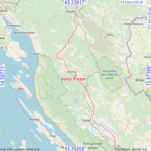
Gornji Prozor GPS coordinates[2]
44° 50' 34.008" North, 15° 16' 14.988" East
| Map corner | latitude | longitude |
|---|---|---|
| Upper-left | 45.33917°, | 14.56771° |
| Center: | 44.84278°, | 15.27083° |
| Lower-right: | 44.34208°, | 15.97396° |
| Map W x H: | 110.9×110.9 km | = 68.9×68.9mi |
| max Lat: | 46.52694° ⇑77.1% North |
| Gornji Prozor: | 44.84278° |
| min Lat: | ⇓22.9% South 42.54972° |
| min Long | Gornji Prozor | max Long |
| 13.52389° | 15.27083° | 19.37694° |
| W 13.4%⇐ | ⇒86.6% E |
Elevation
Elevation of Gornji Prozor is 458 m = 1503 ft, and this is 304.7 m = 1000 ft above average elevation for this country.
| Max E: |
827 m = 2713 ft | 3.4% |
| Gornji Prozor | 458 m 1503 ft | |
| Avg. | 153.3 m = 503 ft | |
Min E: |
-1 m = -3 ft | 96.6% |
See also: Croatia elevation on elevation.city.
Geographical zone
Gornji Prozor is located in North temperate zone (between Tropic of Cancer and the Arctic Circle). Distance of this Northern Tropic circle is 2380.1 km =1478.9 mi to South.| Distance of | km | miles | from Gornji Prozor |
|---|---|---|---|
| North Pole | 5021 | 3119.9 | to North |
| Arctic Circle | 2415.1 | 1500.7 | to North |
| Tropic Cancer | 2380.1 | 1478.9 | to South |
| Equator | 4986 | 3098.2 | to South |


Nearby cities:
15 places around Gornji Prozor: (largest is in red/bold)
• Brinje
20.8 km =12.9 mi,  328°
328°
• Gospić
34 km =21.1 mi,  166°
166°
• Križpolje
21.5 km =13.4 mi,  337°
337°
• Kuterevo
10.4 km =6.5 mi,  259°
259°
• Lički Osik
29.2 km =18.1 mi,  155°
155°
• Ličko Lešće
6 km =3.7 mi,  134°
134°
• Otočac
4 km =2.5 mi,  318°
318°
• Perušić
23.3 km =14.5 mi, 157°
• Plaški
27.1 km =16.8 mi,  16°
16°
• Popovača
23.8 km =14.8 mi,  197°
197°
• Saborsko
22.6 km =14 mi,  46°
46°
• Senj
33 km =20.5 mi,  299°
299°
• Sinac
5.1 km =3.2 mi,  107°
107°
• Vrhovine
11.7 km =7.3 mi,  85°
85°
• Čovići
2.9 km =1.8 mi,  124°
124°
Sources, notices
• [Note1] Compared only with cities in Croatia existing in our database
• [Src1] Map data: © OpenStreetMap contributors (CC-BY-SA)
• [Src2] Other city data from geonames.org with taken over terms of usage.
• [Src3] Geographical zone / Annual Mean Temperature by Robert A. Rohde @ Wikipedia
