Oprtalj geodata
Oprtalj (Istria) is a seat of a second-order administrative division; located in Croatia in Europe/Zagreb (GMT+2) time zone. In our database, there are 904 cities with bigger population. Compared to other cities in Croatia, 52.6% of cities are located further ↑North; 98.2% of cities are located further →East and 93.8% of cities have lower elevation than Oprtalj. Note1


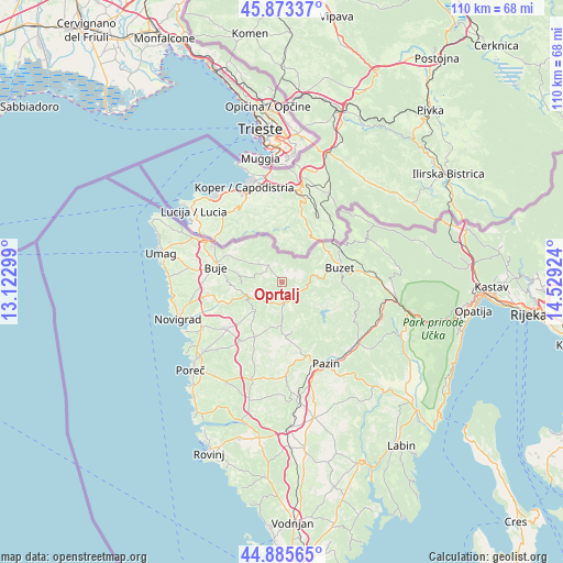
Oprtalj GPS coordinates[2]
45° 22' 54.012" North, 13° 49' 33.996" East
| Map corner | latitude | longitude |
|---|---|---|
| Upper-left | 45.87337°, | 13.12299° |
| Center: | 45.38167°, | 13.82611° |
| Lower-right: | 44.88565°, | 14.52924° |
| Map W x H: | 109.8×109.8 km | = 68.2×68.2mi |
| max Lat: | 46.52694° ⇑52.6% North |
| Oprtalj: | 45.38167° |
| min Lat: | ⇓47.4% South 42.54972° |
| min Long | Oprtalj | max Long |
| 13.52389° | 13.82611° | 19.37694° |
| W 1.8%⇐ | ⇒98.2% E |
Elevation
Elevation of Oprtalj is 354 m = 1161 ft, and this is 200.7 m = 658 ft above average elevation for this country.
| Max E: |
827 m = 2713 ft | 6.2% |
| Oprtalj | 354 m 1161 ft | |
| Avg. | 153.3 m = 503 ft | |
Min E: |
-1 m = -3 ft | 93.8% |
See also: Croatia elevation on elevation.city.
Geographical zone
Oprtalj is located in North temperate zone (between Tropic of Cancer and the Arctic Circle). Distance of this North polar circle is 2355.2 km =1463.5 mi to North.| Distance of | km | miles | from Oprtalj |
|---|---|---|---|
| North Pole | 4961.1 | 3082.7 | to North |
| Arctic Circle | 2355.2 | 1463.5 | to North |
| Tropic Cancer | 2440 | 1516.1 | to South |
| Equator | 5046 | 3135.4 | to South |


Nearby cities:
15 places around Oprtalj: (largest is in red/bold)
• Brtonigla
15.4 km =9.6 mi,  269°
269°
• Buje
13.2 km =8.2 mi,  283°
283°
• Buzet
11.4 km =7.1 mi,  74°
74°
• Cerovlje
18.6 km =11.6 mi,  128°
128°
• Grožnjan
8 km =5 mi, 267°
• Karojba
9 km =5.6 mi,  181°
181°
• Kaštelir
14 km =8.7 mi,  231°
231°
• Motovun
5 km =3.1 mi, 177°
• Novigrad
22.2 km =13.8 mi,  250°
250°
• Pazin
17.9 km =11.1 mi,  151°
151°
• Tar
18.1 km =11.2 mi,  240°
240°
• Tinjan
18.2 km =11.3 mi, 176°
• Visignano
14.3 km =8.9 mi,  215°
215°
• Vižinada
7.8 km =4.8 mi, 222°
• Červar-Porat
21.7 km =13.5 mi, 235°
Sources, notices
• [Note1] Compared only with cities in Croatia existing in our database
• [Src1] Map data: © OpenStreetMap contributors (CC-BY-SA)
• [Src2] Other city data from geonames.org with taken over terms of usage.
• [Src3] Geographical zone / Annual Mean Temperature by Robert A. Rohde @ Wikipedia
