Gornja Bistra geodata
Gornja Bistra (Zagrebačka) is a populated place; located in Croatia in Europe/Zagreb (GMT+2) time zone. With population of 1,836 people, there are 239 cities with bigger population in this country. Compared to other cities in Croatia, 78.4% of cities are located further ↓South; 71.8% of cities are located further →East and 81.3% of cities have lower elevation than Gornja Bistra. Note1


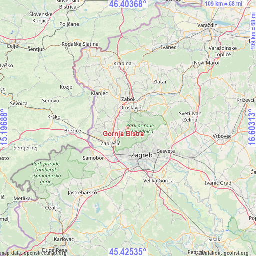
Gornja Bistra GPS coordinates[2]
45° 55' 0.012" North, 15° 54' 0" East
| Map corner | latitude | longitude |
|---|---|---|
| Upper-left | 46.40368°, | 15.19688° |
| Center: | 45.91667°, | 15.9° |
| Lower-right: | 45.42535°, | 16.60313° |
| Map W x H: | 108.8×108.8 km | = 67.6×67.6mi |
| max Lat: | 46.52694° ⇑21.6% North |
| Gornja Bistra: | 45.91667° |
| min Lat: | ⇓78.4% South 42.54972° |
| min Long | Gornja Bistra | max Long |
| 13.52389° | 15.9° | 19.37694° |
| W 28.2%⇐ | ⇒71.8% E |
Elevation
Elevation of Gornja Bistra is 214 m = 702 ft, and this is 60.7 m = 199 ft above average elevation for this country.
| Max E: |
827 m = 2713 ft | 18.7% |
| Gornja Bistra | 214 m 702 ft | |
| Avg. | 153.3 m = 503 ft | |
Min E: |
-1 m = -3 ft | 81.3% |
See also: Croatia elevation on elevation.city.
Geographical zone
Gornja Bistra is located in North temperate zone (between Tropic of Cancer and the Arctic Circle). Distance of this North polar circle is 2295.7 km =1426.5 mi to North.| Distance of | km | miles | from Gornja Bistra |
|---|---|---|---|
| North Pole | 4901.6 | 3045.7 | to North |
| Arctic Circle | 2295.7 | 1426.5 | to North |
| Tropic Cancer | 2499.5 | 1553.1 | to South |
| Equator | 5105.5 | 3172.4 | to South |


Nearby cities:
15 places around Gornja Bistra: (largest is in red/bold)
• Andraševec
8.6 km =5.3 mi,  22°
22°
• Donja Bistra
3.7 km =2.3 mi,  254°
254°
• Donja Stubica
9 km =5.6 mi,  34°
34°
• Igrišće
5.3 km =3.3 mi,  340°
340°
• Jablanovec
5.8 km =3.6 mi,  218°
218°
• Jakovlje
4.1 km =2.5 mi,  302°
302°
• Kupljenovo
7.4 km =4.6 mi,  280°
280°
• Luka
7.7 km =4.8 mi,  306°
306°
• Novaki Bistranski
4.6 km =2.9 mi, 219°
• Oroslavje
9 km =5.6 mi,  7°
7°
• Pojatno
7.8 km =4.8 mi,  260°
260°
• Poljanica Bistranska
2.6 km =1.6 mi,  226°
226°
• Pustodol
7.5 km =4.7 mi,  38°
38°
• Stubička Slatina
7 km =4.3 mi, 342°
• Stubičke Toplice
7 km =4.3 mi, 20°
Sources, notices
• [Note1] Compared only with cities in Croatia existing in our database
• [Src1] Map data: © OpenStreetMap contributors (CC-BY-SA)
• [Src2] Other city data from geonames.org with taken over terms of usage.
• [Src3] Geographical zone / Annual Mean Temperature by Robert A. Rohde @ Wikipedia
