Ouanaminthe geodata
Ouanaminthe (Nord-Est) is a populated place; located in Haiti in America/Port-au-Prince (GMT-4) time zone. With population of 10,118 people, there are 30 cities with bigger population in this country. Compared to other cities in Haiti, 70.8% of cities are located further ↓South; 100% of cities are located further ←West and 52.8% of cities have lower elevation than Ouanaminthe. Note1


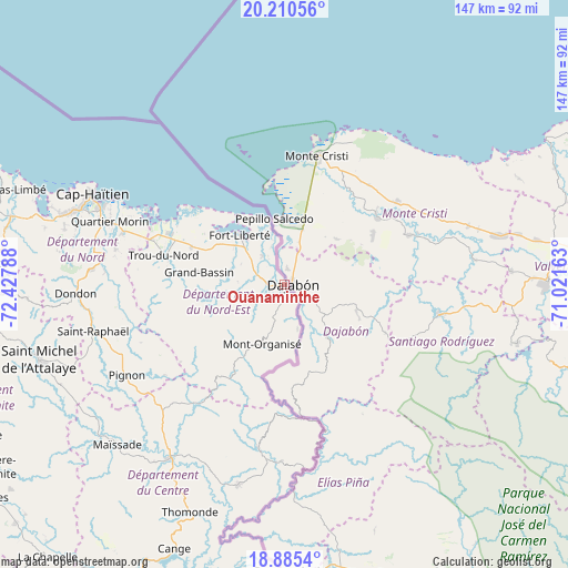
Ouanaminthe GPS coordinates[2]
19° 32' 57.624" North, 71° 43' 29.1" West
| Map corner | latitude | longitude |
|---|---|---|
| Upper-left | 20.21056°, | -72.42788° |
| Center: | 19.54934°, | -71.72475° |
| Lower-right: | 18.8854°, | -71.02163° |
| Map W x H: | 147.3×147.3 km | = 91.5×91.5mi |
| max Lat: | 19.93984° ⇑29.2% North |
| Ouanaminthe: | 19.54934° |
| min Lat: | ⇓70.8% South 18.05° |
| min Long | Ouanaminthe | max Long |
| -74.4528° | -71.72475° | -71.72475° |
| W 100%⇐ | ⇒0% E |
Elevation
Elevation of Ouanaminthe is 39 m = 128 ft, and this is 106.1 m = 348 ft below average elevation for this country.
| Max E: |
1466 m = 4810 ft | 47.2% |
| Avg. | 145.1 m = 476 ft | |
| Ouanaminthe | 39 m = 128 ft | |
Min E: |
3 m = 10 ft | 52.8% |
See also: Haiti elevation on elevation.city.
Geographical zone
Ouanaminthe is located in North Torrid zone (between Equator and Tropic of Cancer). Distance of this Northern Tropic circle is 432.2 km =268.6 mi to North.| Distance of | km | miles | from Ouanaminthe |
|---|---|---|---|
| North Pole | 7833.4 | 4867.4 | to North |
| Arctic Circle | 5227.5 | 3248.2 | to North |
| Tropic Cancer | 432.2 | 268.6 | to North |
| Equator | 2173.7 | 1350.7 | to South |


Nearby cities:
15 places around Ouanaminthe: (largest is in red/bold)
• Acul Samedi
16.8 km =10.4 mi,  258°
258°
• Bahon
41.8 km =26 mi, 257°
• Caracol
34.5 km =21.4 mi,  297°
297°
• Carice
22 km =13.7 mi,  210°
210°
• Cerca la Source
43.1 km =26.8 mi,  189°
189°
• Dérac
15 km =9.3 mi,  321°
321°
• Ferrier
9.2 km =5.7 mi, 322°
• Fort Liberté
17.3 km =10.7 mi, 316°
• Grande Rivière du Nord
46.6 km =29 mi,  273°
273°
• Limonade
44 km =27.3 mi,  287°
287°
• Montòrganize
16.8 km =10.4 mi,  200°
200°
• Perches
21 km =13 mi, 261°
• Phaëton
22.8 km =14.2 mi,  307°
307°
• Ranquitte
40.3 km =25 mi,  247°
247°
• Trou du Nord
32.3 km =20.1 mi,  283°
283°
Sources, notices
• [Note1] Compared only with cities in Haiti existing in our database
• [Src1] Map data: © OpenStreetMap contributors (CC-BY-SA)
• [Src2] Other city data from geonames.org with taken over terms of usage.
• [Src3] Geographical zone / Annual Mean Temperature by Robert A. Rohde @ Wikipedia
