Léogâne geodata
Léogâne (Ouest) is a populated place; located in Haiti in America/Port-au-Prince (GMT-4) time zone. With population of 134,190 people, there are 8 cities with bigger population in this country. Compared to other cities in Haiti, 68.9% of cities are located further ↑North; 54.7% of cities are located further →East and 62.3% of cities have higher elevation than Léogâne. Note1


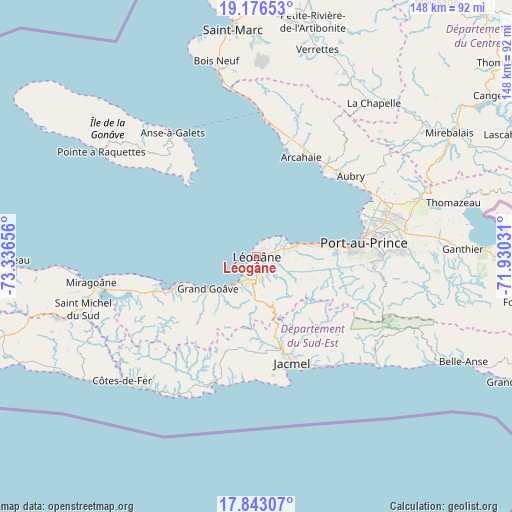
Léogâne GPS coordinates[2]
18° 30' 39.96" North, 72° 38' 0.348" West
| Map corner | latitude | longitude |
|---|---|---|
| Upper-left | 19.17653°, | -73.33656° |
| Center: | 18.5111°, | -72.63343° |
| Lower-right: | 17.84307°, | -71.93031° |
| Map W x H: | 148.3×148.3 km | = 92.1×92.1mi |
| max Lat: | 19.93984° ⇑68.9% North |
| Léogâne: | 18.5111° |
| min Lat: | ⇓31.1% South 18.05° |
| min Long | Léogâne | max Long |
| -74.4528° | -72.63343° | -71.72475° |
| W 45.3%⇐ | ⇒54.7% E |
Elevation
Elevation of Léogâne is 18 m = 59 ft, and this is 127.1 m = 417 ft below average elevation for this country.
| Max E: |
1466 m = 4810 ft | 62.3% |
| Avg. | 145.1 m = 476 ft | |
| Léogâne | 18 m = 59 ft | |
Min E: |
3 m = 10 ft | 37.7% |
See also: Léogâne elevation on elevation.city.
Geographical zone
Léogâne is located in North Torrid zone (between Equator and Tropic of Cancer). Distance of this Northern Tropic circle is 547.7 km =340.3 mi to North.| Distance of | km | miles | from Léogâne |
|---|---|---|---|
| North Pole | 7948.8 | 4939.2 | to North |
| Arctic Circle | 5342.9 | 3319.9 | to North |
| Tropic Cancer | 547.7 | 340.3 | to North |
| Equator | 2058.2 | 1278.9 | to South |


Nearby cities:
15 places around Léogâne: (largest is in red/bold)
• Anse à Galets
43.5 km =27 mi,  325°
325°
• Cabaret
33.7 km =20.9 mi,  42°
42°
• Carrefour
24.9 km =15.5 mi,  82°
82°
• Cayes-Jacmel
40 km =24.9 mi,  141°
141°
• Croix-des-Bouquets
43.5 km =27 mi, 80°
• Delmas 73
35.1 km =21.8 mi, 83°
• Grangwav
17.2 km =10.7 mi,  236°
236°
• Gressier
11.7 km =7.3 mi,  73°
73°
• Jacmel
32.5 km =20.2 mi,  161°
161°
• Kenscoff
37.5 km =23.3 mi,  100°
100°
• Marigot
45.2 km =28.1 mi,  133°
133°
• Miragoâne
48.6 km =30.2 mi,  261°
261°
• Port-au-Prince
31.3 km =19.4 mi, 83°
• Pétionville
36.7 km =22.8 mi,  89°
89°
• Tigwav
26 km =16.2 mi,  250°
250°
Sources, notices
• [Note1] Compared only with cities in Haiti existing in our database
• [Src1] Map data: © OpenStreetMap contributors (CC-BY-SA)
• [Src2] Other city data from geonames.org with taken over terms of usage.
• [Src3] Geographical zone / Annual Mean Temperature by Robert A. Rohde @ Wikipedia
