Tigwav geodata
Tigwav (Ouest) is a populated place; located in Haiti in America/Port-au-Prince (GMT-4) time zone. With population of 117,504 people, there are 10 cities with bigger population in this country. Compared to other cities in Haiti, 75.5% of cities are located further ↑North; 65.1% of cities are located further →East and 67.9% of cities have higher elevation than Tigwav. Note1


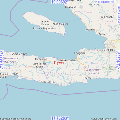
Tigwav GPS coordinates[2]
18° 25' 52.212" North, 72° 51' 54.756" West
| Map corner | latitude | longitude |
|---|---|---|
| Upper-left | 19.09692°, | -73.56834° |
| Center: | 18.43117°, | -72.86521° |
| Lower-right: | 17.76283°, | -72.16209° |
| Map W x H: | 148.3×148.3 km | = 92.1×92.1mi |
| max Lat: | 19.93984° ⇑75.5% North |
| Tigwav: | 18.43117° |
| min Lat: | ⇓24.5% South 18.05° |
| min Long | Tigwav | max Long |
| -74.4528° | -72.86521° | -71.72475° |
| W 34.9%⇐ | ⇒65.1% E |
Elevation
Elevation of Tigwav is 16 m = 52 ft, and this is 129.1 m = 424 ft below average elevation for this country.
| Max E: |
1466 m = 4810 ft | 67.9% |
| Avg. | 145.1 m = 476 ft | |
| Tigwav | 16 m = 52 ft | |
Min E: |
3 m = 10 ft | 32.1% |
See also: Tigwav elevation on elevation.city.
Geographical zone
Tigwav is located in North Torrid zone (between Equator and Tropic of Cancer). Distance of this Northern Tropic circle is 556.6 km =345.9 mi to North.| Distance of | km | miles | from Tigwav |
|---|---|---|---|
| North Pole | 7957.7 | 4944.7 | to North |
| Arctic Circle | 5351.8 | 3325.5 | to North |
| Tropic Cancer | 556.6 | 345.9 | to North |
| Equator | 2049.4 | 1273.4 | to South |


Nearby cities:
15 places around Tigwav: (largest is in red/bold)
• Anse à Galets
44.8 km =27.8 mi,  359°
359°
• Anse-à-Veau
51.2 km =31.8 mi,  278°
278°
• Cabaret
57.9 km =36 mi,  54°
54°
• Carrefour
50.6 km =31.4 mi,  76°
76°
• Cayes-Jacmel
54.3 km =33.7 mi,  114°
114°
• Fond des Blancs
32.5 km =20.2 mi,  238°
238°
• Grangwav
10.1 km =6.3 mi,  93°
93°
• Gressier
37.7 km =23.4 mi,  71°
71°
• Jacmel
41.1 km =25.5 mi,  122°
122°
• Kotdefè
30.6 km =19 mi,  208°
208°
• Lazil
58.2 km =36.2 mi,  264°
264°
• Léogâne
26 km =16.2 mi, 70°
• Miragoâne
23.7 km =14.7 mi,  273°
273°
• Petite Rivière de Nippes
39.3 km =24.4 mi, 277°
• Port-au-Prince
56.9 km =35.4 mi, 77°
Sources, notices
• [Note1] Compared only with cities in Haiti existing in our database
• [Src1] Map data: © OpenStreetMap contributors (CC-BY-SA)
• [Src2] Other city data from geonames.org with taken over terms of usage.
• [Src3] Geographical zone / Annual Mean Temperature by Robert A. Rohde @ Wikipedia
