Valkó geodata
Valkó (Pest) is a populated place; located in Hungary in Europe/Budapest (GMT+2) time zone. With population of 2,461 people, there are 627 cities with bigger population in this country. Compared to other cities in Hungary, 60.3% of cities are located further ↓South; 50% of cities are located further ←West and 79.1% of cities have lower elevation than Valkó. Note1


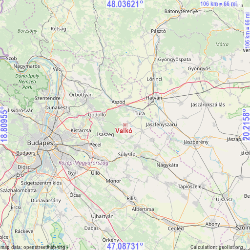
Valkó GPS coordinates[2]
47° 33' 50.076" North, 19° 30' 45.612" East
| Map corner | latitude | longitude |
|---|---|---|
| Upper-left | 48.03621°, | 18.80955° |
| Center: | 47.56391°, | 19.51267° |
| Lower-right: | 47.08731°, | 20.2158° |
| Map W x H: | 105.5×105.5 km | = 65.6×65.6mi |
| max Lat: | 48.46667° ⇑39.7% North |
| Valkó: | 47.56391° |
| min Lat: | ⇓60.3% South 45.79108° |
| min Long | Valkó | max Long |
| 16.27358° | 19.51267° | 22.68096° |
| W 50%⇐ | ⇒50% E |
Elevation
Elevation of Valkó is 155 m = 509 ft, and this is 25.3 m = 83 ft above average elevation for this country.
| Max E: |
444 m = 1457 ft | 20.9% |
| Valkó | 155 m 509 ft | |
| Avg. | 129.7 m = 426 ft | |
Min E: |
71 m = 233 ft | 79.1% |
See also: Hungary elevation on elevation.city.
Geographical zone
Valkó is located in North temperate zone (between Tropic of Cancer and the Arctic Circle). Distance of this North polar circle is 2112.6 km =1312.7 mi to North.| Distance of | km | miles | from Valkó |
|---|---|---|---|
| North Pole | 4718.5 | 2931.9 | to North |
| Arctic Circle | 2112.6 | 1312.7 | to North |
| Tropic Cancer | 2682.7 | 1667 | to South |
| Equator | 5288.6 | 3286.2 | to South |


Nearby cities:
15 places around Valkó: (largest is in red/bold)
• Aszód
10.1 km =6.3 mi,  345°
345°
• Bag
8 km =5 mi,  344°
344°
• Domony
11.8 km =7.3 mi,  329°
329°
• Dány
5.4 km =3.4 mi,  154°
154°
• Galgahévíz
7.1 km =4.4 mi,  34°
34°
• Gödöllő
12.4 km =7.7 mi,  287°
287°
• Hévízgyörk
7.7 km =4.8 mi,  2°
2°
• Iklad
12.7 km =7.9 mi, 333°
• Isaszeg
9.1 km =5.7 mi,  245°
245°
• Kartal
12.1 km =7.5 mi,  10°
10°
• Kóka
10 km =6.2 mi, 150°
• Sülysáp
12.5 km =7.8 mi,  172°
172°
• Tura
8.4 km =5.2 mi,  53°
53°
• Vácszentlászló
2.2 km =1.4 mi,  59°
59°
• Zsámbok
7.7 km =4.8 mi,  106°
106°
Sources, notices
• [Note1] Compared only with cities in Hungary existing in our database
• [Src1] Map data: © OpenStreetMap contributors (CC-BY-SA)
• [Src2] Other city data from geonames.org with taken over terms of usage.
• [Src3] Geographical zone / Annual Mean Temperature by Robert A. Rohde @ Wikipedia
