Nagydorog geodata
Nagydorog (Tolna) is a populated place; located in Hungary in Europe/Budapest (GMT+2) time zone. With population of 2,787 people, there are 541 cities with bigger population in this country. Compared to other cities in Hungary, 82.3% of cities are located further ↑North; 74.2% of cities are located further →East and 67.6% of cities have higher elevation than Nagydorog. Note1


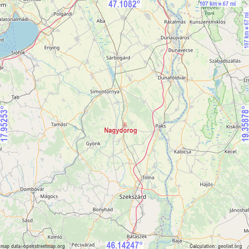
Nagydorog GPS coordinates[2]
46° 37' 38.964" North, 18° 39' 20.34" East
| Map corner | latitude | longitude |
|---|---|---|
| Upper-left | 47.1082°, | 17.95253° |
| Center: | 46.62749°, | 18.65565° |
| Lower-right: | 46.14247°, | 19.35878° |
| Map W x H: | 107.4×107.4 km | = 66.7×66.7mi |
| max Lat: | 48.46667° ⇑82.3% North |
| Nagydorog: | 46.62749° |
| min Lat: | ⇓17.7% South 45.79108° |
| min Long | Nagydorog | max Long |
| 16.27358° | 18.65565° | 22.68096° |
| W 25.8%⇐ | ⇒74.2% E |
Elevation
Elevation of Nagydorog is 104 m = 341 ft, and this is 25.7 m = 84 ft below average elevation for this country.
| Max E: |
444 m = 1457 ft | 67.6% |
| Avg. | 129.7 m = 426 ft | |
| Nagydorog | 104 m = 341 ft | |
Min E: |
71 m = 233 ft | 32.4% |
See also: Hungary elevation on elevation.city.
Geographical zone
Nagydorog is located in North temperate zone (between Tropic of Cancer and the Arctic Circle). Distance of this North polar circle is 2216.7 km =1377.4 mi to North.| Distance of | km | miles | from Nagydorog |
|---|---|---|---|
| North Pole | 4822.6 | 2996.6 | to North |
| Arctic Circle | 2216.7 | 1377.4 | to North |
| Tropic Cancer | 2578.6 | 1602.3 | to South |
| Equator | 5184.5 | 3221.5 | to South |


Nearby cities:
15 places around Nagydorog: (largest is in red/bold)
• Alap
19.3 km =12 mi,  7°
7°
• Cece
16 km =9.9 mi,  352°
352°
• Dunaszentgyörgy
16.6 km =10.3 mi,  131°
131°
• Fadd
22 km =13.7 mi,  145°
145°
• Gyönk
15.8 km =9.8 mi,  239°
239°
• Hőgyész
23.2 km =14.4 mi,  231°
231°
• Madocsa
24 km =14.9 mi,  73°
73°
• Németkér
12.8 km =8 mi,  39°
39°
• Ozora
23.9 km =14.9 mi,  305°
305°
• Paks
15.3 km =9.5 mi,  92°
92°
• Pincehely
17.5 km =10.9 mi,  289°
289°
• Simontornya
16.1 km =10 mi,  331°
331°
• Szedres
17 km =10.6 mi,  172°
172°
• Tengelic
11.8 km =7.3 mi,  158°
158°
• Tolna
24.3 km =15.1 mi, 156°
Sources, notices
• [Note1] Compared only with cities in Hungary existing in our database
• [Src1] Map data: © OpenStreetMap contributors (CC-BY-SA)
• [Src2] Other city data from geonames.org with taken over terms of usage.
• [Src3] Geographical zone / Annual Mean Temperature by Robert A. Rohde @ Wikipedia
