Erdőkertes geodata
Erdőkertes (Pest) is a populated place; located in Hungary in Europe/Budapest (GMT+2) time zone. With population of 5,996 people, there are 254 cities with bigger population in this country. Compared to other cities in Hungary, 68.5% of cities are located further ↓South; 54.3% of cities are located further →East and 93.6% of cities have lower elevation than Erdőkertes. Note1


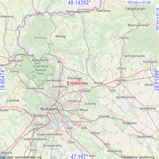
Erdőkertes GPS coordinates[2]
47° 40' 21.396" North, 19° 18' 28.296" East
| Map corner | latitude | longitude |
|---|---|---|
| Upper-left | 48.14392°, | 18.60474° |
| Center: | 47.67261°, | 19.30786° |
| Lower-right: | 47.197°, | 20.01099° |
| Map W x H: | 105.3×105.3 km | = 65.4×65.4mi |
| max Lat: | 48.46667° ⇑31.5% North |
| Erdőkertes: | 47.67261° |
| min Lat: | ⇓68.5% South 45.79108° |
| min Long | Erdőkertes | max Long |
| 16.27358° | 19.30786° | 22.68096° |
| W 45.7%⇐ | ⇒54.3% E |
Elevation
Elevation of Erdőkertes is 210 m = 689 ft, and this is 80.3 m = 263 ft above average elevation for this country.
| Max E: |
444 m = 1457 ft | 6.4% |
| Erdőkertes | 210 m 689 ft | |
| Avg. | 129.7 m = 426 ft | |
Min E: |
71 m = 233 ft | 93.6% |
See also: Hungary elevation on elevation.city.
Geographical zone
Erdőkertes is located in North temperate zone (between Tropic of Cancer and the Arctic Circle). Distance of this North polar circle is 2100.5 km =1305.2 mi to North.| Distance of | km | miles | from Erdőkertes |
|---|---|---|---|
| North Pole | 4706.4 | 2924.4 | to North |
| Arctic Circle | 2100.5 | 1305.2 | to North |
| Tropic Cancer | 2694.8 | 1674.5 | to South |
| Equator | 5300.7 | 3293.7 | to South |


Nearby cities:
15 places around Erdőkertes: (largest is in red/bold)
• Aszód
13 km =8.1 mi,  100°
100°
• Domony
9.5 km =5.9 mi, 101°
• Dunakeszi
13.3 km =8.3 mi,  252°
252°
• Fót
10.8 km =6.7 mi,  235°
235°
• Galgamácsa
6.5 km =4 mi,  66°
66°
• Göd
13.1 km =8.1 mi,  275°
275°
• Gödöllő
9.2 km =5.7 mi,  157°
157°
• Iklad
9.6 km =6 mi,  94°
94°
• Kerepes
12.7 km =7.9 mi,  188°
188°
• Mogyoród
9.8 km =6.1 mi,  211°
211°
• Szada
4.4 km =2.7 mi,  171°
171°
• Sződ
11.8 km =7.3 mi,  299°
299°
• Sződliget
13.7 km =8.5 mi, 299°
• Veresegyház
3.1 km =1.9 mi,  197°
197°
• Őrbottyán
2.5 km =1.6 mi,  310°
310°
Sources, notices
• [Note1] Compared only with cities in Hungary existing in our database
• [Src1] Map data: © OpenStreetMap contributors (CC-BY-SA)
• [Src2] Other city data from geonames.org with taken over terms of usage.
• [Src3] Geographical zone / Annual Mean Temperature by Robert A. Rohde @ Wikipedia
