Veresegyház geodata
Veresegyház (Pest) is a populated place; located in Hungary in Europe/Budapest (GMT+2) time zone. With population of 11,087 people, there are 150 cities with bigger population in this country. Compared to other cities in Hungary, 66.3% of cities are located further ↓South; 54.5% of cities are located further →East and 85.5% of cities have lower elevation than Veresegyház. Note1


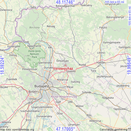
Veresegyház GPS coordinates[2]
47° 38' 45.24" North, 19° 17' 43.296" East
| Map corner | latitude | longitude |
|---|---|---|
| Upper-left | 48.11746°, | 18.59224° |
| Center: | 47.6459°, | 19.29536° |
| Lower-right: | 47.17005°, | 19.99849° |
| Map W x H: | 105.3×105.3 km | = 65.4×65.4mi |
| max Lat: | 48.46667° ⇑33.7% North |
| Veresegyház: | 47.6459° |
| min Lat: | ⇓66.3% South 45.79108° |
| min Long | Veresegyház | max Long |
| 16.27358° | 19.29536° | 22.68096° |
| W 45.5%⇐ | ⇒54.5% E |
Elevation
Elevation of Veresegyház is 175 m = 574 ft, and this is 45.3 m = 149 ft above average elevation for this country.
| Max E: |
444 m = 1457 ft | 14.5% |
| Veresegyház | 175 m 574 ft | |
| Avg. | 129.7 m = 426 ft | |
Min E: |
71 m = 233 ft | 85.5% |
See also: Hungary elevation on elevation.city.
Geographical zone
Veresegyház is located in North temperate zone (between Tropic of Cancer and the Arctic Circle). Distance of this North polar circle is 2103.4 km =1307 mi to North.| Distance of | km | miles | from Veresegyház |
|---|---|---|---|
| North Pole | 4709.3 | 2926.2 | to North |
| Arctic Circle | 2103.4 | 1307 | to North |
| Tropic Cancer | 2691.8 | 1672.6 | to South |
| Equator | 5297.7 | 3291.8 | to South |


Nearby cities:
15 places around Veresegyház: (largest is in red/bold)
• Csömör
11.6 km =7.2 mi,  203°
203°
• Domony
10.3 km =6.4 mi,  84°
84°
• Dunakeszi
11.8 km =7.3 mi,  264°
264°
• Erdőkertes
3.1 km =1.9 mi,  17°
17°
• Fót
8.6 km =5.3 mi,  248°
248°
• Galgamácsa
8.8 km =5.5 mi,  51°
51°
• Göd
12.8 km =8 mi,  288°
288°
• Gödöllő
7.1 km =4.4 mi,  140°
140°
• Iklad
10.8 km =6.7 mi, 78°
• Kerepes
9.6 km =6 mi,  185°
185°
• Kistarcsa
11.2 km =7 mi, 192°
• Mogyoród
6.8 km =4.2 mi,  217°
217°
• Nagytarcsa
12.8 km =8 mi,  184°
184°
• Szada
2.1 km =1.3 mi,  131°
131°
• Őrbottyán
4.7 km =2.9 mi,  348°
348°
Sources, notices
• [Note1] Compared only with cities in Hungary existing in our database
• [Src1] Map data: © OpenStreetMap contributors (CC-BY-SA)
• [Src2] Other city data from geonames.org with taken over terms of usage.
• [Src3] Geographical zone / Annual Mean Temperature by Robert A. Rohde @ Wikipedia
