Fábiánsebestyén geodata
Fábiánsebestyén (Csongrád) is a populated place; located in Hungary in Europe/Budapest (GMT+2) time zone. With population of 2,276 people, there are 682 cities with bigger population in this country. Compared to other cities in Hungary, 81.2% of cities are located further ↑North; 71% of cities are located further ←West and 99.3% of cities have higher elevation than Fábiánsebestyén. Note1


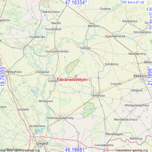
Fábiánsebestyén GPS coordinates[2]
46° 40' 59.988" North, 20° 28' 0.012" East
| Map corner | latitude | longitude |
|---|---|---|
| Upper-left | 47.16354°, | 19.76355° |
| Center: | 46.68333°, | 20.46667° |
| Lower-right: | 46.19881°, | 21.1698° |
| Map W x H: | 107.3×107.3 km | = 66.7×66.7mi |
| max Lat: | 48.46667° ⇑81.2% North |
| Fábiánsebestyén: | 46.68333° |
| min Lat: | ⇓18.8% South 45.79108° |
| min Long | Fábiánsebesty | max Long |
| 16.27358° | 20.46667° | 22.68096° |
| W 71%⇐ | ⇒29% E |
Elevation
Elevation of Fábiánsebestyén is 79 m = 259 ft, and this is 50.7 m = 166 ft below average elevation for this country.
| Max E: |
444 m = 1457 ft | 99.3% |
| Avg. | 129.7 m = 426 ft | |
| Fábiánsebestyén | 79 m = 259 ft | |
Min E: |
71 m = 233 ft | 0.7% |
See also: Hungary elevation on elevation.city.
Geographical zone
Fábiánsebestyén is located in North temperate zone (between Tropic of Cancer and the Arctic Circle). Distance of this North polar circle is 2210.5 km =1373.5 mi to North.| Distance of | km | miles | from Fábiánsebestyén |
|---|---|---|---|
| North Pole | 4816.4 | 2992.8 | to North |
| Arctic Circle | 2210.5 | 1373.5 | to North |
| Tropic Cancer | 2584.8 | 1606.1 | to South |
| Equator | 5190.7 | 3225.4 | to South |


Nearby cities:
15 places around Fábiánsebestyén: (largest is in red/bold)
• Békésszentandrás
20.4 km =12.7 mi,  3°
3°
• Csongrád
25 km =15.5 mi,  277°
277°
• Gádoros
10.3 km =6.4 mi,  100°
100°
• Kardos
23 km =14.3 mi,  56°
56°
• Kondoros
27 km =16.8 mi,  69°
69°
• Kunszentmárton
22 km =13.7 mi,  321°
321°
• Mindszent
27.6 km =17.1 mi,  229°
229°
• Nagyszénás
15.3 km =9.5 mi,  90°
90°
• Orosháza
20 km =12.4 mi,  130°
130°
• Szarvas
21.4 km =13.3 mi,  17°
17°
• Szegvár
21.4 km =13.3 mi,  240°
240°
• Szelevény
24.1 km =15 mi,  303°
303°
• Szentes
16 km =9.9 mi,  259°
259°
• Székkutas
21 km =13 mi,  165°
165°
• Öcsöd
24.6 km =15.3 mi,  348°
348°
Sources, notices
• [Note1] Compared only with cities in Hungary existing in our database
• [Src1] Map data: © OpenStreetMap contributors (CC-BY-SA)
• [Src2] Other city data from geonames.org with taken over terms of usage.
• [Src3] Geographical zone / Annual Mean Temperature by Robert A. Rohde @ Wikipedia
