Sátoraljaújhely geodata
Sátoraljaújhely (Borsod-Abaúj-Zemplén) is a seat of a second-order administrative division; located in Hungary in Europe/Budapest (GMT+2) time zone. With population of 18,052 people, there are 95 cities with bigger population in this country. Compared to other cities in Hungary, 99.7% of cities are located further ↓South; 89.8% of cities are located further ←West and 62.4% of cities have higher elevation than Sátoraljaújhely. Note1


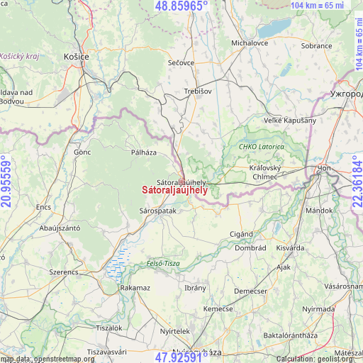
Sátoraljaújhely GPS coordinates[2]
48° 23' 41.712" North, 21° 39' 31.356" East
| Map corner | latitude | longitude |
|---|---|---|
| Upper-left | 48.85965°, | 20.95559° |
| Center: | 48.39492°, | 21.65871° |
| Lower-right: | 47.92591°, | 22.36184° |
| Map W x H: | 103.8×103.8 km | = 64.5×64.5mi |
| max Lat: | 48.46667° ⇑0.3% North |
| Sátoraljaújhely: | 48.39492° |
| min Lat: | ⇓99.7% South 45.79108° |
| min Long | Sátoraljaújhe | max Long |
| 16.27358° | 21.65871° | 22.68096° |
| W 89.8%⇐ | ⇒10.2% E |
Elevation
Elevation of Sátoraljaújhely is 108 m = 354 ft, and this is 21.7 m = 71 ft below average elevation for this country.
| Max E: |
444 m = 1457 ft | 62.4% |
| Avg. | 129.7 m = 426 ft | |
| Sátoraljaújhely | 108 m = 354 ft | |
Min E: |
71 m = 233 ft | 37.6% |
See also: Hungary elevation on elevation.city.
Geographical zone
Sátoraljaújhely is located in North temperate zone (between Tropic of Cancer and the Arctic Circle). Distance of this North polar circle is 2020.2 km =1255.3 mi to North.| Distance of | km | miles | from Sátoraljaújhely |
|---|---|---|---|
| North Pole | 4626.1 | 2874.5 | to North |
| Arctic Circle | 2020.2 | 1255.3 | to North |
| Tropic Cancer | 2775.1 | 1724.4 | to South |
| Equator | 5381 | 3343.6 | to South |


Nearby cities:
15 places around Sátoraljaújhely: (largest is in red/bold)
• Buj
32.8 km =20.4 mi,  181°
181°
• Cigánd
23.2 km =14.4 mi,  131°
131°
• Dombrád
27.1 km =16.8 mi, 131°
• Döge
33.3 km =20.7 mi,  116°
116°
• Gönc
28.8 km =17.9 mi,  286°
286°
• Ibrány
30.4 km =18.9 mi,  172°
172°
• Karcsa
14.3 km =8.9 mi, 130°
• Nagyhalász
30.1 km =18.7 mi, 165°
• Olaszliszka
23.2 km =14.4 mi,  225°
225°
• Ricse
24.3 km =15.1 mi,  108°
108°
• Sárospatak
10 km =6.2 mi,  218°
218°
• Tiszabercel
27.2 km =16.9 mi, 181°
• Tiszakarád
22.1 km =13.7 mi, 168°
• Tolcsva
19.8 km =12.3 mi, 231°
• Újdombrád
27.2 km =16.9 mi,  144°
144°
In other languages:
- In German: Sátoraljaújhely, Neustadt am Zeltberg
- In Russian: Шаторальяуйхей
- In Chinese: 沙托勞爾堯烏伊海伊
Sources, notices
• [Note1] Compared only with cities in Hungary existing in our database
• [Src1] Map data: © OpenStreetMap contributors (CC-BY-SA)
• [Src2] Other city data from geonames.org with taken over terms of usage.
• [Src3] Geographical zone / Annual Mean Temperature by Robert A. Rohde @ Wikipedia
