Hajdúnánás geodata
Hajdúnánás (Hajdú-Bihar) is a seat of a second-order administrative division; located in Hungary in Europe/Budapest (GMT+2) time zone. With population of 18,032 people, there are 96 cities with bigger population in this country. Compared to other cities in Hungary, 80.2% of cities are located further ↓South; 87.2% of cities are located further ←West and 75.1% of cities have higher elevation than Hajdúnánás. Note1


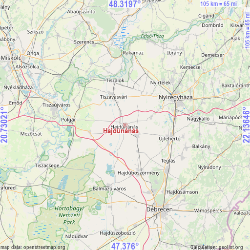
Hajdúnánás GPS coordinates[2]
47° 51' 0" North, 21° 25' 59.988" East
| Map corner | latitude | longitude |
|---|---|---|
| Upper-left | 48.3197°, | 20.73021° |
| Center: | 47.85°, | 21.43333° |
| Lower-right: | 47.376°, | 22.13646° |
| Map W x H: | 104.9×104.9 km | = 65.2×65.2mi |
| max Lat: | 48.46667° ⇑19.8% North |
| Hajdúnánás: | 47.85° |
| min Lat: | ⇓80.2% South 45.79108° |
| min Long | Hajdúnánás | max Long |
| 16.27358° | 21.43333° | 22.68096° |
| W 87.2%⇐ | ⇒12.8% E |
Elevation
Elevation of Hajdúnánás is 98 m = 322 ft, and this is 31.7 m = 104 ft below average elevation for this country.
| Max E: |
444 m = 1457 ft | 75.1% |
| Avg. | 129.7 m = 426 ft | |
| Hajdúnánás | 98 m = 322 ft | |
Min E: |
71 m = 233 ft | 24.9% |
See also: Hungary elevation on elevation.city.
Geographical zone
Hajdúnánás is located in North temperate zone (between Tropic of Cancer and the Arctic Circle). Distance of this North polar circle is 2080.8 km =1292.9 mi to North.| Distance of | km | miles | from Hajdúnánás |
|---|---|---|---|
| North Pole | 4686.6 | 2912.1 | to North |
| Arctic Circle | 2080.8 | 1292.9 | to North |
| Tropic Cancer | 2714.5 | 1686.7 | to South |
| Equator | 5320.4 | 3305.9 | to South |


Nearby cities:
15 places around Hajdúnánás: (largest is in red/bold)
• Görbeháza
15 km =9.3 mi,  262°
262°
• Hajdúböszörmény
21.3 km =13.2 mi,  163°
163°
• Hajdúdorog
6.2 km =3.9 mi,  126°
126°
• Hajdúhadház
25.4 km =15.8 mi,  136°
136°
• Kálmánháza
11.8 km =7.3 mi,  71°
71°
• Nagycserkesz
15 km =9.3 mi,  29°
29°
• Nyíregyháza
24.2 km =15 mi,  60°
60°
• Nyírtelek
23.8 km =14.8 mi,  38°
38°
• Polgár
23.7 km =14.7 mi,  274°
274°
• Tiszadada
24.5 km =15.2 mi,  326°
326°
• Tiszaeszlár
22.4 km =13.9 mi,  6°
6°
• Tiszalök
18.9 km =11.7 mi,  348°
348°
• Tiszavasvári
14.4 km =8.9 mi, 334°
• Téglás
23.8 km =14.8 mi, 128°
• Újfehértó
19.5 km =12.1 mi,  106°
106°
Sources, notices
• [Note1] Compared only with cities in Hungary existing in our database
• [Src1] Map data: © OpenStreetMap contributors (CC-BY-SA)
• [Src2] Other city data from geonames.org with taken over terms of usage.
• [Src3] Geographical zone / Annual Mean Temperature by Robert A. Rohde @ Wikipedia
