Papringan geodata
Papringan (Central Java) is a seat of a fourth-order administrative division; located in Indonesia in Asia/Jakarta (GMT+7) time zone. In our database, there are 407 cities with bigger population. Compared to other cities in Indonesia, 55.9% of cities are located further ↑North; 66.1% of cities are located further →East and 68.4% of cities have higher elevation than Papringan. Note1


Papringan GPS coordinates[2]
7° 30' 14.004" South, 109° 14' 53.988" East
| Map corner | latitude | longitude |
|---|---|---|
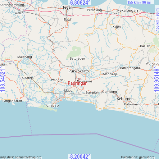
| Upper-left | -6.80624°, | 108.54521° |
| Center: | -7.50389°, | 109.24833° |
| Lower-right: | -8.20042°, | 109.95146° |
| Map W x H: | 155×155 km | = 96.3×96.3mi |
| max Lat: | 5.88969° ⇑55.9% North |
| Papringan: | -7.50389° |
| min Lat: | ⇓44.1% South -10.934° |
| min Long | Papringan | max Long |
| 95.1345° | 109.24833° | 140.9419° |
| W 33.9%⇐ | ⇒66.1% E |
Elevation
Elevation of Papringan is 35 m = 115 ft, and this is 194.7 m = 639 ft below average elevation for this country.
| Max E: |
3185 m = 10449 ft | 68.4% |
| Avg. | 229.7 m = 754 ft | |
| Papringan | 35 m = 115 ft | |
Min E: |
-1 m = -3 ft | 31.6% |
See also: Indonesia elevation on elevation.city.
Geographical zone
Papringan is located in South Torrid zone (between Equator and Tropic of Capricorn). Distance of Equator is 834.4 km =518.5 mi to North.| Distance of | km | miles | from Papringan |
|---|---|---|---|
| Equator | 834.4 | 518.5 | to North |
| Tropic Capricorn | 1771.6 | 1100.8 | to South |
| Antarctic Circle | 6566.8 | 4080.4 | to South |
| South Pole | 9172.7 | 5699.6 | to South |


Nearby cities:
15 places around Papringan: (largest is in red/bold)
• Banyumas
5.2 km =3.2 mi,  102°
102°
• Binangun
3.7 km =2.3 mi,  182°
182°
• Brak
6.9 km =4.3 mi,  206°
206°
• Gambarsari
6 km =3.7 mi,  239°
239°
• Gambolempuk
7.3 km =4.5 mi,  194°
194°
• Garbi
3.7 km =2.3 mi,  272°
272°
• Karangjati
9 km =5.6 mi,  197°
197°
• Karangtengah
9.4 km =5.8 mi,  223°
223°
• Kebasen
6.3 km =3.9 mi, 238°
• Pesawahan
9.2 km =5.7 mi,  255°
255°
• Purwokerto
9.3 km =5.8 mi,  350°
350°
• Rawalo
8.5 km =5.3 mi, 244°
• Sampang
8.7 km =5.4 mi, 220°
• Sampang Selatan
8.8 km =5.5 mi, 217°
• Sokaraja
6.7 km =4.2 mi,  40°
40°
Sources, notices
• [Note1] Compared only with cities in Indonesia existing in our database
• [Src1] Map data: © OpenStreetMap contributors (CC-BY-SA)
• [Src2] Other city data from geonames.org with taken over terms of usage.
• [Src3] Geographical zone / Annual Mean Temperature by Robert A. Rohde @ Wikipedia
