Wololele A geodata
Wololele A (East Nusa Tenggara) is a seat of a fourth-order administrative division; located in Indonesia in Asia/Makassar (GMT+8) time zone. In our database, there are 407 cities with bigger population. Compared to other cities in Indonesia, 90.6% of cities are located further ↑North; 87.8% of cities are located further ←West and 96.4% of cities have lower elevation than Wololele A. Note1


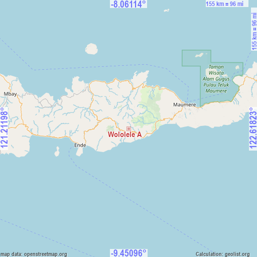
Wololele A GPS coordinates[2]
8° 45' 24.12" South, 121° 54' 54.36" East
| Map corner | latitude | longitude |
|---|---|---|
| Upper-left | -8.06114°, | 121.21198° |
| Center: | -8.7567°, | 121.9151° |
| Lower-right: | -9.45096°, | 122.61823° |
| Map W x H: | 154.5×154.5 km | = 96×96mi |
| max Lat: | 5.88969° ⇑90.6% North |
| Wololele A: | -8.7567° |
| min Lat: | ⇓9.4% South -10.934° |
| min Long | Wololele A | max Long |
| 95.1345° | 121.9151° | 140.9419° |
| W 87.8%⇐ | ⇒12.2% E |
Elevation
Elevation of Wololele A is 906 m = 2972 ft, and this is 676.3 m = 2219 ft above average elevation for this country.
| Max E: |
3185 m = 10449 ft | 3.6% |
| Wololele A | 906 m 2972 ft | |
| Avg. | 229.7 m = 754 ft | |
Min E: |
-1 m = -3 ft | 96.4% |
See also: Indonesia elevation on elevation.city.
Geographical zone
Wololele A is located in South Torrid zone (between Equator and Tropic of Capricorn). Distance of Equator is 973.7 km =605 mi to North.| Distance of | km | miles | from Wololele A |
|---|---|---|---|
| Equator | 973.7 | 605 | to North |
| Tropic Capricorn | 1632.3 | 1014.3 | to South |
| Antarctic Circle | 6427.5 | 3993.9 | to South |
| South Pole | 9033.4 | 5613.1 | to South |


Nearby cities:
15 places around Wololele A: (largest is in red/bold)
• Aemalu
3.4 km =2.1 mi,  107°
107°
• Aeteke
8.4 km =5.2 mi,  124°
124°
• Aipetu
8 km =5 mi, 122°
• Baolokan
3.6 km =2.2 mi,  234°
234°
• Jitapanda
5.1 km =3.2 mi, 115°
• Koanara
7 km =4.3 mi,  277°
277°
• Liabeke
2.5 km =1.6 mi,  149°
149°
• Maubasa
8 km =5 mi,  165°
165°
• Ratenggoji
8 km =5 mi,  1°
1°
• Woloara
5.9 km =3.7 mi,  79°
79°
• Wolobela
4.8 km =3 mi,  63°
63°
• Wolofeo
9.1 km =5.7 mi, 64°
• Wololele B
2.5 km =1.6 mi,  255°
255°
• Wolowaru
4.4 km =2.7 mi, 227°
• Wonda
4.5 km =2.8 mi, 147°
Sources, notices
• [Note1] Compared only with cities in Indonesia existing in our database
• [Src1] Map data: © OpenStreetMap contributors (CC-BY-SA)
• [Src2] Other city data from geonames.org with taken over terms of usage.
• [Src3] Geographical zone / Annual Mean Temperature by Robert A. Rohde @ Wikipedia
