Langnga geodata
Langnga (South Sulawesi) is a seat of a third-order administrative division; located in Indonesia in Asia/Makassar (GMT+8) time zone. In our database, there are 407 cities with bigger population. Compared to other cities in Indonesia, 89.7% of cities are located further ↓South; 81.9% of cities are located further ←West and 92.1% of cities have higher elevation than Langnga. Note1


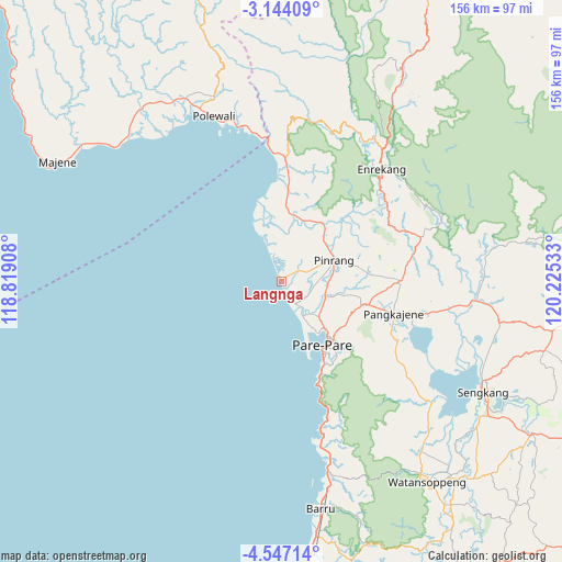
Langnga GPS coordinates[2]
3° 50' 45.24" South, 119° 31' 19.92" East
| Map corner | latitude | longitude |
|---|---|---|
| Upper-left | -3.14409°, | 118.81908° |
| Center: | -3.8459°, | 119.5222° |
| Lower-right: | -4.54714°, | 120.22533° |
| Map W x H: | 156×156 km | = 96.9×96.9mi |
| max Lat: | 5.88969° ⇑10.3% North |
| Langnga: | -3.8459° |
| min Lat: | ⇓89.7% South -10.934° |
| min Long | Langnga | max Long |
| 95.1345° | 119.5222° | 140.9419° |
| W 81.9%⇐ | ⇒18.1% E |
Elevation
Elevation of Langnga is 9 m = 30 ft, and this is 220.7 m = 724 ft below average elevation for this country.
| Max E: |
3185 m = 10449 ft | 92.1% |
| Avg. | 229.7 m = 754 ft | |
| Langnga | 9 m = 30 ft | |
Min E: |
-1 m = -3 ft | 7.9% |
See also: Indonesia elevation on elevation.city.
Geographical zone
Langnga is located in South Torrid zone (between Equator and Tropic of Capricorn). Distance of Equator is 427.6 km =265.7 mi to North.| Distance of | km | miles | from Langnga |
|---|---|---|---|
| Equator | 427.6 | 265.7 | to North |
| Tropic Capricorn | 2178.3 | 1353.5 | to South |
| Antarctic Circle | 6973.6 | 4333.2 | to South |
| South Pole | 9579.4 | 5952.4 | to South |


Nearby cities:
15 places around Langnga: (largest is in red/bold)
• Amparita
36.1 km =22.4 mi,  117°
117°
• Baranti
29 km =18 mi,  88°
88°
• Cakke
57.3 km =35.6 mi,  32°
32°
• Cempa Pasar
12.8 km =8 mi, 32°
• Enrekang
41.6 km =25.8 mi,  41°
41°
• Harapankarya
20.9 km =13 mi,  139°
139°
• Lampa
20.3 km =12.6 mi,  3°
3°
• Majennang
17.1 km =10.6 mi,  145°
145°
• Parepare
21.9 km =13.6 mi, 148°
• Pinrang
15.9 km =9.9 mi,  65°
65°
• Polewali
50.1 km =31.1 mi,  336°
336°
• Rappang
32.7 km =20.3 mi, 89°
• Sidenreng
32.1 km =19.9 mi,  106°
106°
• Teppo
22.6 km =14 mi,  46°
46°
• Uluale
25.5 km =15.8 mi, 105°
Sources, notices
• [Note1] Compared only with cities in Indonesia existing in our database
• [Src1] Map data: © OpenStreetMap contributors (CC-BY-SA)
• [Src2] Other city data from geonames.org with taken over terms of usage.
• [Src3] Geographical zone / Annual Mean Temperature by Robert A. Rohde @ Wikipedia
