Palue geodata
Palue (East Nusa Tenggara) is a seat of a fourth-order administrative division; located in Indonesia in Asia/Makassar (GMT+8) time zone. In our database, there are 407 cities with bigger population. Compared to other cities in Indonesia, 82.3% of cities are located further ↑North; 89.2% of cities are located further ←West and 83.2% of cities have lower elevation than Palue. Note1


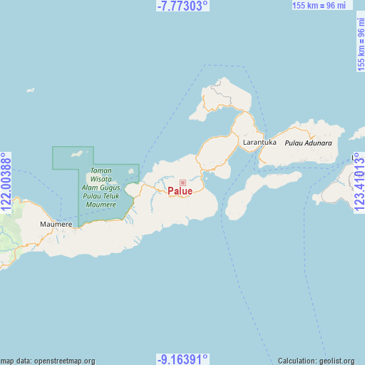
Palue GPS coordinates[2]
8° 28' 8.76" South, 122° 42' 25.2" East
| Map corner | latitude | longitude |
|---|---|---|
| Upper-left | -7.77303°, | 122.00388° |
| Center: | -8.4691°, | 122.707° |
| Lower-right: | -9.16391°, | 123.41013° |
| Map W x H: | 154.7×154.7 km | = 96.1×96.1mi |
| max Lat: | 5.88969° ⇑82.3% North |
| Palue: | -8.4691° |
| min Lat: | ⇓17.7% South -10.934° |
| min Long | Palue | max Long |
| 95.1345° | 122.707° | 140.9419° |
| W 89.2%⇐ | ⇒10.8% E |
Elevation
Elevation of Palue is 484 m = 1588 ft, and this is 254.3 m = 834 ft above average elevation for this country.
| Max E: |
3185 m = 10449 ft | 16.8% |
| Palue | 484 m 1588 ft | |
| Avg. | 229.7 m = 754 ft | |
Min E: |
-1 m = -3 ft | 83.2% |
See also: Indonesia elevation on elevation.city.
Geographical zone
Palue is located in South Torrid zone (between Equator and Tropic of Capricorn). Distance of Equator is 941.7 km =585.1 mi to North.| Distance of | km | miles | from Palue |
|---|---|---|---|
| Equator | 941.7 | 585.1 | to North |
| Tropic Capricorn | 1664.2 | 1034.1 | to South |
| Antarctic Circle | 6459.5 | 4013.7 | to South |
| South Pole | 9065.4 | 5633 | to South |


Nearby cities:
15 places around Palue: (largest is in red/bold)
• Blaloudeng
11.9 km =7.4 mi,  49°
49°
• Boganatar
8.3 km =5.2 mi,  241°
241°
• Boru
6.3 km =3.9 mi,  176°
176°
• Buri
14.6 km =9.1 mi, 53°
• Duang
10.1 km =6.3 mi,  167°
167°
• Gerong
11.1 km =6.9 mi, 52°
• Hewa
13.8 km =8.6 mi, 180°
• Hila
14.7 km =9.1 mi,  224°
224°
• Kanada
8 km =5 mi,  57°
57°
• Konga
7.8 km =4.8 mi,  75°
75°
• Lato
12.6 km =7.8 mi,  26°
26°
• Lewolaga
12.5 km =7.8 mi, 63°
• Nobo
9.3 km =5.8 mi,  101°
101°
• Nurabelen
14.1 km =8.8 mi,  112°
112°
• Sukutukang
3.9 km =2.4 mi, 168°
Sources, notices
• [Note1] Compared only with cities in Indonesia existing in our database
• [Src1] Map data: © OpenStreetMap contributors (CC-BY-SA)
• [Src2] Other city data from geonames.org with taken over terms of usage.
• [Src3] Geographical zone / Annual Mean Temperature by Robert A. Rohde @ Wikipedia
