Blaloudeng geodata
Blaloudeng (East Nusa Tenggara) is a seat of a fourth-order administrative division; located in Indonesia in Asia/Makassar (GMT+8) time zone. In our database, there are 407 cities with bigger population. Compared to other cities in Indonesia, 80.3% of cities are located further ↑North; 89.3% of cities are located further ←West and 62% of cities have lower elevation than Blaloudeng. Note1


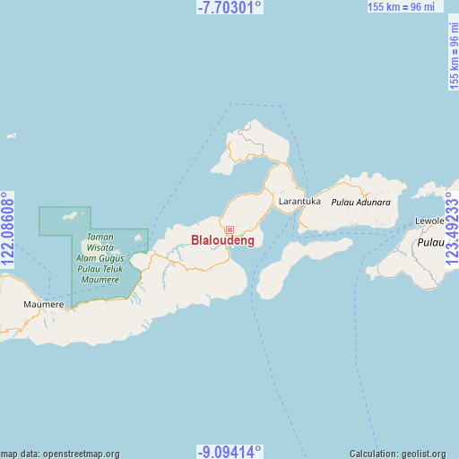
Blaloudeng GPS coordinates[2]
8° 23' 57.12" South, 122° 47' 21.12" East
| Map corner | latitude | longitude |
|---|---|---|
| Upper-left | -7.70301°, | 122.08608° |
| Center: | -8.3992°, | 122.7892° |
| Lower-right: | -9.09414°, | 123.49233° |
| Map W x H: | 154.7×154.7 km | = 96.1×96.1mi |
| max Lat: | 5.88969° ⇑80.3% North |
| Blaloudeng: | -8.3992° |
| min Lat: | ⇓19.7% South -10.934° |
| min Long | Blaloudeng | max Long |
| 95.1345° | 122.7892° | 140.9419° |
| W 89.3%⇐ | ⇒10.7% E |
Elevation
Elevation of Blaloudeng is 185 m = 607 ft, and this is 44.7 m = 147 ft below average elevation for this country.
| Max E: |
3185 m = 10449 ft | 38% |
| Avg. | 229.7 m = 754 ft | |
| Blaloudeng | 185 m = 607 ft | |
Min E: |
-1 m = -3 ft | 62% |
See also: Indonesia elevation on elevation.city.
Geographical zone
Blaloudeng is located in South Torrid zone (between Equator and Tropic of Capricorn). Distance of Equator is 933.9 km =580.3 mi to North.| Distance of | km | miles | from Blaloudeng |
|---|---|---|---|
| Equator | 933.9 | 580.3 | to North |
| Tropic Capricorn | 1672 | 1038.9 | to South |
| Antarctic Circle | 6467.3 | 4018.6 | to South |
| South Pole | 9073.2 | 5637.8 | to South |


Nearby cities:
15 places around Blaloudeng: (largest is in red/bold)
• Bama
10.4 km =6.5 mi,  75°
75°
• Buri
2.8 km =1.7 mi,  70°
70°
• Eputobi
4.9 km =3 mi,  102°
102°
• Gerong
1.1 km =0.7 mi,  190°
190°
• Kanada
4.1 km =2.5 mi,  213°
213°
• Konga
6 km =3.7 mi, 194°
• Lamika
6.1 km =3.8 mi,  108°
108°
• Lato
4.9 km =3 mi,  315°
315°
• Lewokluok
6.8 km =4.2 mi,  85°
85°
• Lewolaga
3.2 km =2 mi,  135°
135°
• Lewoluo
9.2 km =5.7 mi,  1°
1°
• Leworook
4.4 km =2.7 mi, 72°
• Nobo
9.6 km =6 mi,  179°
179°
• Palue
11.9 km =7.4 mi,  229°
229°
• Wolo
7.1 km =4.4 mi, 94°
Sources, notices
• [Note1] Compared only with cities in Indonesia existing in our database
• [Src1] Map data: © OpenStreetMap contributors (CC-BY-SA)
• [Src2] Other city data from geonames.org with taken over terms of usage.
• [Src3] Geographical zone / Annual Mean Temperature by Robert A. Rohde @ Wikipedia
