Lato geodata
Lato (East Nusa Tenggara) is a seat of a fourth-order administrative division; located in Indonesia in Asia/Makassar (GMT+8) time zone. In our database, there are 407 cities with bigger population. Compared to other cities in Indonesia, 79.3% of cities are located further ↑North; 89.2% of cities are located further ←West and 66.8% of cities have higher elevation than Lato. Note1


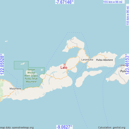
Lato GPS coordinates[2]
8° 22' 3.72" South, 122° 45' 30.24" East
| Map corner | latitude | longitude |
|---|---|---|
| Upper-left | -7.67146°, | 122.05528° |
| Center: | -8.3677°, | 122.7584° |
| Lower-right: | -9.0627°, | 123.46153° |
| Map W x H: | 154.7×154.7 km | = 96.1×96.1mi |
| max Lat: | 5.88969° ⇑79.3% North |
| Lato: | -8.3677° |
| min Lat: | ⇓20.7% South -10.934° |
| min Long | Lato | max Long |
| 95.1345° | 122.7584° | 140.9419° |
| W 89.2%⇐ | ⇒10.8% E |
Elevation
Elevation of Lato is 38 m = 125 ft, and this is 191.7 m = 629 ft below average elevation for this country.
| Max E: |
3185 m = 10449 ft | 66.8% |
| Avg. | 229.7 m = 754 ft | |
| Lato | 38 m = 125 ft | |
Min E: |
-1 m = -3 ft | 33.2% |
See also: Indonesia elevation on elevation.city.
Geographical zone
Lato is located in South Torrid zone (between Equator and Tropic of Capricorn). Distance of Equator is 930.4 km =578.1 mi to North.| Distance of | km | miles | from Lato |
|---|---|---|---|
| Equator | 930.4 | 578.1 | to North |
| Tropic Capricorn | 1675.5 | 1041.1 | to South |
| Antarctic Circle | 6470.8 | 4020.8 | to South |
| South Pole | 9076.7 | 5640 | to South |


Nearby cities:
15 places around Lato: (largest is in red/bold)
• Bama
13.5 km =8.4 mi,  93°
93°
• Blaloudeng
4.9 km =3 mi,  135°
135°
• Buri
6.6 km =4.1 mi,  112°
112°
• Eputobi
9.3 km =5.8 mi,  119°
119°
• Gerong
5.6 km =3.5 mi,  145°
145°
• Kanada
7 km =4.3 mi,  171°
171°
• Konga
9.5 km =5.9 mi, 168°
• Lamika
10.6 km =6.6 mi, 120°
• Lewokluok
10.6 km =6.6 mi, 106°
• Lewolaga
8 km =5 mi, 135°
• Lewoluo
6.7 km =4.2 mi,  32°
32°
• Leworook
7.9 km =4.9 mi, 105°
• Nobo
13.5 km =8.4 mi, 165°
• Palue
12.6 km =7.8 mi,  206°
206°
• Wolo
11.3 km =7 mi, 111°
Sources, notices
• [Note1] Compared only with cities in Indonesia existing in our database
• [Src1] Map data: © OpenStreetMap contributors (CC-BY-SA)
• [Src2] Other city data from geonames.org with taken over terms of usage.
• [Src3] Geographical zone / Annual Mean Temperature by Robert A. Rohde @ Wikipedia
